Posts Tagged ‘flash floods again’
SPRING 2016 West Yorks and Yonder

Astro meteorology has been around for a couple of millennia and hasn’t brought any harm to the planet. Astro mets use tried and tested and highly honed techniques, along with fantastic insights from George McCormack who used Pearce, Goad and other brilliant astro mets, to add to Kepler and ancient mariner laws of celestial-terrestrial converging , to give long range forecasts of a meteorological nature.
We use satellite technology that has been around since time began and you can be very assured that long range astro meteorological forecasting doesn’t harm the planet at all.

Spring: West Yorks and Yonder 2016
The best outlook arrives 14th April when we see some nice spring days, but this is followed by an Arctic all time low to freeze any bedding plants, noses and toes, so beware the sudden seasonal turnaround.I don’t see any prolonged spells of great weather for May and June, and the floods seem likely to return at the run up to Summer solstice, but hopefully I might be wrong….
Spring is on time this year, but it may feel weathergeddon has broken out as very unsettled conditions continue.
There is a meteorological hit, and potentially man made disaster around the Orkney Islands, from the start of the equinox, sometimes this has been either military or law enforcement incident, and pollution around those parts, could be another drill explosion or sperm whale/ drillkill from the start of the season.

20th-23rd March
The Western areas gather warmth but this creates moisture as well, with eastern parts of GB meeting precipitation created by it over the coming days.
Flooding to some regions expected due to heavy levels of rainy outbursts, my forecast is for these to travel south easterly from NW Scotland moving SE to northern England and southwards, to eastern parts. I don’t see floods to Cumbria from this weather outburst for this phase, though already saturated areas wont be exempt from the assault. North Yorks and Northumberland more prone to flood news and Derry region of Ireland seems to get some bad weather too for this phase.
20th Very unsettled with sporadic strong gusty winds mists, fogs and mizzles from around sunrise, could be some sun attempts during the day but varying weather patterns move faster over next few days from NW to SE
21st Pluvial conditions with highs levels of mist, fogs and mizzles expected to linger, heavy rain from the start of the day and not much sun around as clouds linger to obscure it and mists and fogs in valleys cling to watery places. The evening is a better bet for slightly clearer skies, but no promises as this weather remains unsettled.
22nd Rainy outbursts come in with warm air from the west, heavy at the start of day, news of very strong winds. Flooding to already saturated areas
 23rd-31st March
The Full Moon phase is normally the time of month when we get bad weather being moved away for a few days but this is and equatorial Full Moon and might operate slightly differently to herald some disturbed atmospherics as Spring birthing pains continue.
Some high tides may create sea disturbance to West of Ireland there is also high seismicity operative.
I see clearer skies but cold to eastern parts but some windy outbursts.
From the outset the damp air can create mould conditions for those gardeners with seeds or young plants growing.
An ancient meteorologist Junctinius tells us, when the eclipse is in an air sign there is scarcity, pestilence and tempests….so beware all you gardeners!
23rd Sporadic spurts often gusty in nature and westerly. A wet start but weather systems moving quickly along so will be an all weather day today though some breaks in the cloud will allow the sun to peek through now and again to say hello.. Expect gentle breezes to low lying areas but colder stronger winds to slightly higher altitudes. By evening some cold and gloomy conditions could hang around along with fogs and mists
24th Strong gusty westerlies today and winds could scatter some showers around a finer outlook by evening and clearer skies but this herald’s frost and strong ozone. Sleet and hail outbreaks 6-9 pm, localised, will leave likelihood of overnight frosts.
25th Some hope for warmer temps after a nippy start to the day, so some ice will begin to thaw. Finer outlook till mid day with mid afternoon showery outbursts mid afternoon, more prevalent to the north. Cloud around overnight.
26th High humidity with mists and cloud around but this is marked down as a nice Spring day on my calendar.
27th Cool frosty start again and another day like yesterday.
28th-30th Fair afternoon and evenings but mists to low lying areas and cloud forming later by evening so unsettled, but mostly dry.
30th Fair weather to the north lower temps expected but some showery outbursts likely from mid afternoon
31st This looks very exciting and wild and windy with strong gales at high speed along corridors to the NW/Scotland to keep everyone engaged with the weather dramas.
31st March-7th April
Gales at high speed across high transport routes will create traffic disruptions for a few days, air traffic and bridges affected too to NW/Scotland. Communication systems will also be affected along with electricity routes. Stormy conditions to northern parts.
Spring temps higher to the eastern regions.
31st. As previous, it looks dry for W Yorks but very very blustery, though there will be some warmth from sunshine letting us know Spring is here.
1st-4th Wont see settled weather but will have some dry days with occasionally gusty winds and breezes. Temps average for Spring though some cool crisp outlook for 2nd, fairer conditions stay in North England
4th Some potential for rainy outbreaks later in the day along with whippy westerlies. Some pollution expected to N Eastern areas.
5th-7th Very unsettled outlook, low temps, cloud around but also some accompanying fair spring weather in the mix
 7th-14th April
The New Moon on 7th is perigee and closest of the year, and with Moon equatorial we normally would expect some entertaining weather dramas, but this being April it looks less like fireworks and more like damp squib.
From Hebrides to Spain via the Irish Sea looks like having mists and mellow fruitfulness, and more cloud developing as well as sea frets.
Some sea turbulence to sea far South West of Ireland for a few days, and some of it could hit NW Scotland but it is seafarers that need to take heed and listen to shipping forecasts.
7th Shows gentle breezes and spring like conditions.
8th Some mists or showers around mid morning but also some fine spring weather as Venus heads northward in declination, promising a Spring to put winter behind us.
9th Cool crisp with some blue skies to enjoy
10th Northern weather may change a little now, mists around, milder temps and some occasional gusty breezes. Any showers arrive from 4pm.
11th similar to yesterday
12th -13th Temps rising seasonally higher sun with cloud and mist potential, northerlies active, but there may also be some very heavy showery outbreaks too as heavens flood gates open, this seems more heavy to southern areas such Somerset regions, but Wales may also see some tidal surge too.
14th Mists and mizzles with northerlies trying to clear up worst of the weather.
 14th-22nd April
This phase looks pleasantly spring like with some good outdoor weather to enjoy.
The Mid Atlantic looks choppy from the start and sea NW of Scotland seems rough with some precipitation travelling into north parts but doesn’t seems strong enough to reach further than North of England by 16th A second weather system to reach NW Scotland arrives a little more turbulence, but with not enough strength to travel further SE into England.
London is hit by mists and fogs that could disrupt air travel from 14th with a fine outlook ahead of that to the east.
14th The start of day could see mists to valleys but eventually brings a fine Spring outlook with blue skies and white fluffy clouds although some strong blustery winds and breezes could interrupt at sporadic intervals.
15th Continues yesterday’s trend with some cooling off by late evening after some warmth during the day
16th Some showery release potentially just April showers, localised hail but clearing after mid day
17th sun with cloud during the day, generally fair outlook
18th Fair outlook again but the winds could get more lively turning gusty over next few days
19th-22nd are likely to bring better temps to the south England with seasonal rise in warmth, gusty conditions but for us a continuing trend of fair Spring weather with warmth.
 22nd April-30th April
This phase sees a direct contrast to the pleasant days previously enjoyed. Winter returns with a vengeance to assault Spring and we can expect Arctic lows fetching a big freeze to your nose and toes. You will experience sudden deep steep drops in temps so don’t take bright sunshine for granted. Highly likely that overnight gives clear skies but that means that little warmth is allowed to develop.
22nd Cold and penetrating some damp, drizzle and mizzle along with hail sleet and snow sporadic outbursts, the latter to high regions the former to low lying valleys. Gusty westerlies provide extra cutting chill and can be quite lashing at times.
23rd Frosty overnight and icy with more intermittent sporadic and localised varying wintery showery outbursts to mid morning Exceedingly cold to NW and high places.
24th Breathtakingly cold an intense cold front reigns and higher precipitation will hit the south of England with magnetic disturbances interfering with some comms.
25th -27th continues cold and frosty along with icy cold breezes. From today some rivers may be flooding and western regions look likely to be swamped on flood plains. Mists hover around watering places in lowlands while freezing fogs will arrive to high areas.
28th A tiny bit milder weather outlook takes the edge off the breathtaking chilly factor; clouds and mists but some sunshine might break through if we get lucky!….
29th Frosts less widespread, some thawing out and mists hide sunshine and easterlies keep it still a little bit gloomy.
30th Milder temps, less harsh and some sunshine around but could see some showery outbursts by evening

30th April-6th May
Rain forms out to sea NW coast of Scotland, clearly we need a rain carrier out there to catch it before it arrives….
Normally systems like this take two days to come inland so precipitation for NW Scotland travelling SE over two days, but I think it stays north of W Yorks and yonder.
Temps move towards less intense and thawing begins as moderating influences grow stronger towards the end of this phase.
30th as above with some mists or fogs around lingering over valleys with sun finding it hard to move them along.
1st Cloud around, hazes and mists with atmospherics disturbed for the next few days at high altitudes to the north so mountaineering radio addicts beware….your frequencies may freeze up!
2nd Rain arrives to Scotland’s shores as mentioned earlier. West Yorks get milder temps moving over but it still feels a bit muggy, so can’t see how good the day will turn out however…it wont be as bad as last week!
3rd HURRAH. Nice day, but some showery potential later in the afternoon or evening depending upon where you live for example Lancashire folk get these systems a few hours before we do………..
4th-6th The weather moves along slowly now, some sunshine and haziness and cloud around but temps improve all the time.
6th Some wild funnels of high speed corridors of wind could create wind funnels or mini tornadoes to W Midlands and lower SW belts. News of avalanches expected as thawing completes the phase.
 6th May- 13th May
I think for W Yorks this could be a dry phase with little rain to spoil play. For places yonder some drama could roll out in the form of static outbursts, thunder, lightening or both from 7th-9th as temperatures rise.
6th As above, fairer to S Eng, with mists clouds or mizzles drizzles to north around 4pm. A dry sunny outlook for W Yorks till evening
7th Looks like another spring day to enjoy with any rain coming overnight, some migrating static outbursts circulating generally yonder to W Yorks
8th Static again to South and north but any precipitation is soon forgotten as seasonal temps rise with likelihood of a fine day to come. The NW looks the worst hit early morning, it may try pour some remaining rain here, but the outlook is for a seasonally warm Spring day for W Yorks
9th Temps peaking, calm misty start, sultry weather in warmth
10th Looks like a serene day with blue skies and little clouds and sun shining down….nice day
11th Some cloud around but still nearly as good as yesterday. Before mid night would be time when any rain might spoil play, could just be more clouds forming
12th -13th Only mists spoil these days with sun and haziness likely, breezy southerlies active. Temps adjust to lower slightly.
 13th-21st May
A rather drill tour of weather for this phase with temps lowering from the highs of previous days reaching quite damp and chilly for the last part as precipitation cools the air, and by 20th singled out for coolest of the phase.
The second half changes in more unsettled conditions with precipitation upsetting some regions, more to the Northern parts.
13th-15th starts with some likelihood of static and mists from 13th, but sunshine likely during the daytime. 14th brings in some southerly breezes and moderate temps prevail, some sunshine during the day and same on 15th which looks fairer with warmth from the sun.
16th could bring short sharp showery unsettled weather forming, evening most likely time for some quick showery outbursts for W Yorks, as well as at the start of the day. Some sunshine will be around during the day and this trend continues into 17th
18th more showery intervals but these are continuing sporadic and may miss some localities. I expect some record rainfall to some far north western areas from Scotland down to Cumbria. These are isolated micros. We could see some of these waft over in the afternoon–heavy to some localities.
19th The weather begins to see lower range of temps and generally fair for us but interrupted by some intermittent outbursts of widely scattered precipitation for some areas.
20th Mists and cloud with cooler range of temps making things a little chilly and damp. Unsettled weather, misty or cloudy around sunrise with some sunshine later in the morning. Very heavy showers expected for the NW regions for the afternoon, some residue here but clearing late evening.
21st Hopefully today sees off the gloomier stuff but it does augur cool spring temps, but some better weather outdoors breaking out.
 21st-29th May
This phase is very difficult to report due to so many conflicting weather patterns and foul battling fair with few seeming to win out ultimately.
Static outbursts migrates fetching threats of thunder and lightening but rain may or not follow depending on your terrain and location. For sure lower valleys and river clearly show stress by the end of the phase with the potential for high levels of rivers bursting banks and low lying roads under water.
Northerlies operate the first few days trying to settle the weather affair and see off precipitation.
No guarantees for this forecast due to complex and conflicting systems operating.
Basically 21st- 24th brings the fairer outlook but sunshine and warmth can soon disappear and sudden outbursts may threaten the day. 22nd seems to be dry and temps pleasantly rising, this creates more static and humidity, but winds get stirred and some lightening or thundery outbreaks in some regions, may or not bring rain. My bet is on dry for us in W Yorks. 23rd looks a little cloudy perhaps even gloomy but the skies should clear overnight. 24th seems slightly milder with some warmth from the sun after mid day
25th South westerly mix fetches threat of mists, mizzles and some muggy conditions with showery outbursts likely late afternoon. Winds more westerly and gusty later in the day and into following day
26th Seems like a dry day for us rumbles of thunder to distance, along with lightening potential but the NW regions are on the receiving end of the real outpouring
27th a little turbulent; some mists and clouds but a warming factor around to create hope of better things to come, the sun could shine through in stages.
28th Seems like a dry day for us but certainly some precipitation is threatening to head our way and could arrive by evening and continue into the next day turning quite heavy especially to NE Scotland down into Cumbria and southwards, leaving rivers bursting banks and roads in valleys a little bit wet. Buy a canoe!
It’s great to be wrong with a forecast such as this turning into wonderfully dry weather…..but I don’t think that will happen yet…..but hey Mars is perigee now and usually brings in highs….read on….
 29th May-5th June
With Mars now perigee on 30th we normally encounter drought and parching temps so during this phase we will encounter some rising temps drawn up from the South gradually as the phase unfolds.
The South Eng gets the higher ranges from 29th and these gradually move northwards over the coming days.
There are some wonderful features for W Yorks for this phase, much needed after the turbulence rocking around last week. Drought seems more likely for longitudes 2 degrees west of us and places around Auchterarder, Edin and Salcombe Glasgow/Dumfries seem likely to enjoy better, drier weather and higher temps…lucky you!
29th Wet outpourings continue, as before, with rivers at high levels. Around 4pm more rain likely to W Yorks after a cloudy day with some sun around.. Mod temps for the season.
30th Cloudy with sunshine but misty to watery places in valleys, mists and hazes develop evening and early morning as temps rise.
31st–4th looks very fine indeed with some pleasant warmth from the sun, but also some high humidity as residual precipitation dries out. Warmth drawing further northwards from southern regions over these days, as a slow moving weather continues to prevail.
4th Expect some heavy rain arriving for us during the evening after a fair warm sunny day with some cloud around. This will be heavy rainfall continuing into the 5th.
5th a fairer outlook only after mid day….sorry….new rainfall levels established for some western parts for this time of year….

Prettiest Village in Yorkshire Dales
5th-12th June
Sadly it looks like the return to similar weather at the Winter solstice run up, with floodageddon all over again.
Hopefully I am SOOOOoooooo wrong, but I don’t think I am…………….
Lowlands/valleys and river ways, misty and hazy during the daytime and fogs developing at night time.
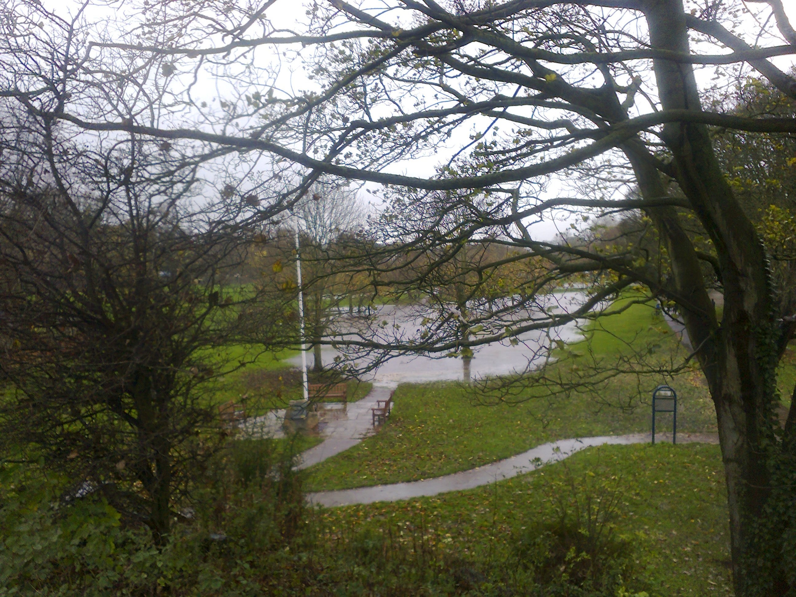
Flash floods keep on coming and if you are in an area outside of NW and SE Scotland and Eng then you might escape the worst of the very wet weather. Flash floods to Western parts at the beginning, move to NE parts see 10-12th
5th as before with heavy precipitation moving around the UK migrating up through northern England into Scotland by 6th W Yorks sees some better weather after rain subsides by evening.
6th Temps reach seasonal highs, but there is a lot of humidity around. Mists may hide sun till mid day.
7th Looks like a better bet weather wise with some sunshine and warmth
8th turn of the day sees heavy rain again but by breakfast onwards sunshine with cloud around, but muggy
9th Sunshine and cloud, south easterlies keep it a bit gloomy but some gusty spurts of westerlies move it along.
10th-12th Looks reasonable for W Yorks but flash flooding to NE Scotland/ England North Yorks too keeps things sombre
12th turns into a nice Spring day…aha if only summer were here…..don’t worry it is coming…..

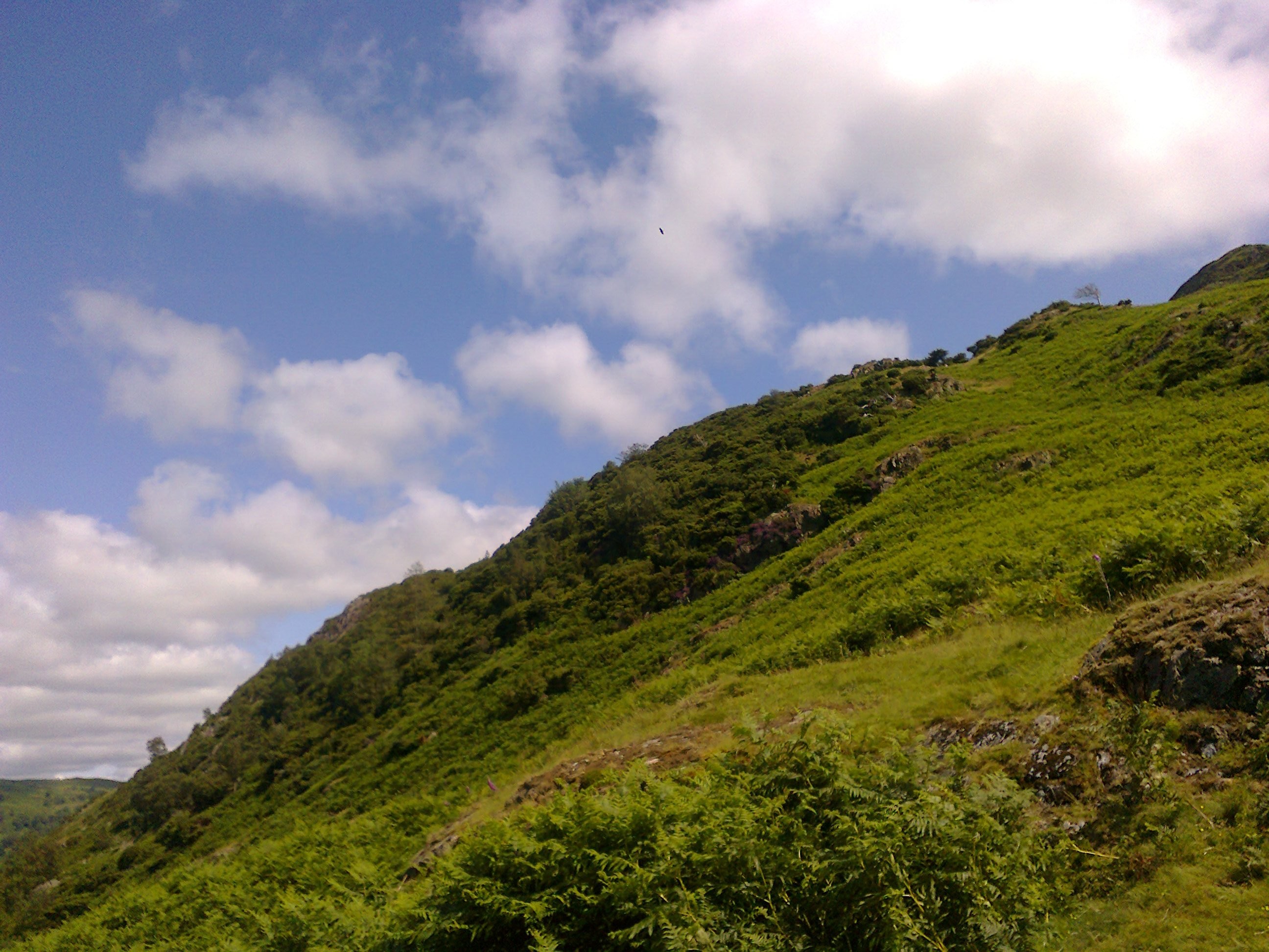
My Favourite Place Friar’s Crag Walk
12th-20th June
I expect more flash floods due to heavy waterlogged areas continuing to get heavy flash downpours NE Scotland/England Northern Yorkshire, Cumbria and Wales from the outset. rivers overflowing and flooding roads and routes in valleys flooded too….all good fun if you are wearing wellies, but not if your home is flooded again, so a great time to book a helping hol with those who are worn out with water…..
Some strong winds along narrow corridors and in high places with likelihood of wind funnels and I expect some tornado to West Midland region around 18th.
For W Yorks and Yonder the 13th June is wet for us around sunrise but for days after it will be very windy with gusty westerlies operative and W Yorks moves towards the solstice on 20th with better drier weather but Summer is coming in on a boat, just like the Egyptian Rah, so expect more stormy waves as the sun rises above the equator….what will summer bring I wonder……
