Archive for the ‘viral spread’ Category
SUMMER WEATHER 2016 West Yorkshire and Yonder
 Long Range Summer Forecast 2016 West Yorkshire and Yonder UK
These forecasts are delivered using ancient satellite technology, tried and tested for millennia and results from such usage first recorded on Antelope Tusks a couple of millennia ago, with method used still working and used by many skilled astro meteorologists who deliver very accurate long range seasonal forecasts for you to plan your season with.
 SUMMER WEATHER 20016 Overview
Summer Season with some highs to come but interrupted by bad bits. 27th June -4th July sees some highs arriving but quick flash floods to some areas as a result. . The real high seem likely to develop for W Yorks by 30th-31st July and 30th August.
Around 14th July tell me if you get the tornado or wind funnel I forecast, for as they are not as spectacular as those in Tornado Alley, US, too few of these get reported in the UK, yet we know they arrive here.
I also see a seismic event for UK around 12th July, so will be watching for news of this as well as for 2nd-10th August showing a seismic outlook for the UK with 1W45 long from Shetland down to W Sussex singled out for source of origin, not sure which latitude but both extremes vulnerable Shetland region gets my vote. Some rumblings of tectonic plates to Celtic Sea also.
Meanwhile Papua New Guinea is exposed to seismicity this phase too.153E30 I’ll be watching out for this one.
26th July-2nd August sees more summer highs but also a drill, spill and kill incident somewhere off either the West of Orkney, the Tay region or Caernarfon area, 3 deg west longitude. 18th-25th August repeats DRILLS, SPILLS and KILLS again, yes it’s that time of year. Offshore W of Shetland, to North Sea and offshore to English Channel 1-2 W long, but may be felt down t/out GB.I expect a few cetaceans on beach too……………………Apologies for so little time to track this and be more specific and to be truthful I always hope I am totally wrong about such forecasts……………………
Heavy rains expected to hit the west by 24th August travelling to W Yorks by 25th with highs following as mentioned earlier.
Venus at equinox 1st September augurs early Autumn cooling, followed by the traditional cyclical start of the Autumn 22nd Sept at Sun’s equinox seeing very heavy rain arriving.

20th-27th June
The good news is this solstice, a beautiful Azores High is forming out in the Atlantic, so book a plane for there now….because the bad news is off the West coast of England a low is developing, stopping the high from coming our way. Oh dear..
Solstice day usually does bring some unsettled weather and 2016 summer solstice day 20th, is no exception.
However, as it operates on a Full Moon day, we can expect some better conditions in the evenings of the first few days at least, but don’t put your brolly to bed just yet. Some disturbances at high altitudes mean the Helm Winds can knock you back on High Cup Nick, Pennine, Moor, or mountain pathways, and radio hams could find disturbances from static in isolated spots. Air and water travel may also see some rocky moments as highs vie with lows, and winds are erratic.
Seasonal temps expected to vary, but on the cool side to begin the season, and likely as not, throughout.
20th Some lows with easterly gloom round, but generally unsettled outlook today as solsticial atmospherics rule. Some rain could be moving eastwards and some mists to valleys and lowlands expected. A few northerly attempts to try clear away any gloom and cloud, but I don’t expect persistent sun today.
21st Temps varying, some showery attempts likely but brief and scattered, cloud around too. Better by evening.
22nd Temps varying again, but cooler range prevail. High humidity, static but some sunny intervals as clouds scurry by.
23rd Potentially the best date to warm your hands on the evening barbecue, sun, cloud around during the day.
24th Not much change from yesterday but could be more clouds to west and potential for a few showery bits over here too.
25th Looks like the threat of heavy showers begins to actualise today and on 26th.
26th I expect some heavy showers from mid morning and some strong whippy westerlies come in with these.
27th Sees the moon on the equator so weather patterns continue eastwards for a few days, but temps will begin to feel more summery from now on. Very sporadic winds with gusts and high speed on exposed areas, see the intro again for warnings given. Cloud around but winds trying to move them on.

27th June-4th July
I expect some record highs for the season along with thundery and lightening outbreaks which will accompany heat moving northwards over coming eight days. Thunderstorms travel east. Any sudden heavy downpours will make way for brighter conditions, with flash floods to valleys expected to quickly pass over on western areas.
Mists and cloud predominantly in western shores. 30th looks the best of this block of weather outcomes.
27th Sultry but winds are still high, gusty on high pathways, in the north mostly.
Intermittent sudden sporadic showery outbursts midnight to early am 28th.
28th and 29th look like the thundery outburst arrive after midnight as temps rise. West Yorks is in their pathway so I don’t expect to escape the onslaught. The days clear by mid day, so afternoons and evenings are generally better for outdoors.
30th Fingers crossed all signs are for a more serene and reliable outlook with temps rising and some sunny weather to enjoy today and for 1st.
2nd Sultry, humid with temps still rising, could bring another static outburst early am before sunrise, not ruling out thunderstorms either, and rainy stuff on 3rd for many areas W Y and far beyond.
3rd –4th Little breeze but some blue skies likely once the wet stuff goes, slowly cooling after 4th.

4th-12th July
Highs stay in the Mid Atlantic sadly and weather systems in GB begin their journey from NW to SE over this phase.
Looks like some pollution across Europe continues to make its presence felt east of our borders (have we got any?)
Heavy outbursts of rain could hit NW regions of England and beyond but may not result in heavy flooding.
4th-5th Could see rain breaking out, heavy at times to NW and west coast regions, and low lying areas. Mists accompany. Fairer to the north with any residual storms of last phase slowly dying as they move SE direction.
6th Some noisy eerie breezy stuff but fair conditions for us and any rainy bits to the west begin to fizzle out as they travel over to our way and S. Easterly
7th Less windy, some clearing skies, but temps on the cool side and any scattered outbreaks will be brief sporadic and around mid morning.
8th Northerlies active and clearing up conditions, some gloomy weather to the west, clouds mists to the east but better outlook by mid day, cloudier evening.
9th Dry day with sunshine and sweet breezes
10th Some gusty winds about today, westerly, some quick showery bursts could accompany, cooling temps, cloudy am but some sun spells.
11th Strong NW winds arise taking weather down south with it. Spurts of very gusty winds on high lands. Some cloud breaks with sun spells with this system.
12th Still windy, cooler and cloud around much like yesterday.

12th-19th July
Breezy windy, wet, cooler, highs to SW travelling further southwards. Unsettled for a few days with potential tornado or wind funnel to Midlands.
Could be a seismic event for us around the 12th too.
12th Very unsettled atmosphere with potential rainy outbursts. Cloud around and mists lingering to some areas. Any rain arrives late evening.
13th Scattered showers before sunrise have a cooling effect on temps, sun plus cloud during the day, clearing skies by evening, but cloudier 9-10pm onwards and rain falling, mists likely.
14th Unsettled again, winds gusty westerly, tornado or wind spouts expected today to NE Scotland and or Midlands. Winds stronger on high ground to North Sunshine and cloud, dry but short scattered spells of rain by 8pm onwards.
15th Some gusty stuff, clearer skies, cool start early am. Showery by 9-10 am but soft breezes for us to dry out by mid day. Some lightening releases static. Sun and clouds around.
17th Cool overnight into early am, more mod after sunrise and looks like weather stays to be fair for next few days…HURRAH!

26th July– 2nd August
This phase sees a drill, spill and kill incident somewhere off either the West of Orkney, the Tay region or Caernarfon area, 3 deg west longitude.
I always wonder when forecasting these, how much sperm whales and dolphins cost to replace….
The three quarter moon often brings in turbulence so best not book a getaway but even if I’m too late with the warning , all wont be lost with some good days to brighten up the phase.
Not a bad week for a British summer, when all is taken into consideration, but some interruptions of good weather expected, but they will be quick unless otherwise forecast. 29th singled out for rainy stuff and 30th-31st gets the highs.
Highs roll out in style to the east of GB, but inland there will be some developing too, with 30th singled out for our region.
Some sudden changes in temps can vary them over the phase so be assured that if it gets cool after rain the sun will soon return to warm you up again.
These are the high temps of Dog Days when Romans were aware there could be searing heat, prolonged, but difficult if on a war march. Hard times for dogs too if tarmac or concrete gets hot, so take care of your dog and don’t leave it in the car on hot days.
A quick tour of these days:
Looks good fine and summery 26th- 28th, with sudden abrupt wind changes and erratic gusts kicking in by 27th
28th looks potentially showery with potential for sporadic isolated hail and sleet, but these won’t stay around and often leave sunny skies in their wake.
29th Oh dear I can guarantee rain, for many GB places in the form of scattered electrical showers. Some energetic gusties around too, with high spots and high altitudes affected.
30th continues as yesterday but the highs are high today, so some good temps as well as sunshine
31st The heat continues
1st August rain potential…sorry this always happens after a hot spell doesn’t it, but it won’t stay around, by sunset it will be better, but sunshine around as well today. Hail and sleet spells look likely to interrupt play and I’m not ruling out quick smattering of snow on very high northern parts……lots of condensation around due to cold air at start of day.
2nd New Moon, good weather sunrise to sunset usually but let’s look at the charts and see shall we……read on

2nd-10th August
A seismic outlook for the UK with 1W45 long from Shetland down to W Sussex singled out for source of origin, not sure which latitude but both extremes vulnerable Shetland region gets my vote. Some rumblings of tectonic plates to Celtic Sea also.
Meanwhile Papua New Guinea is exposed to seismicity this phase too.153E30 I’ll be watching out for this one.
2nd unsettled outlook as seismicity rules, temps still summery but cooling
3rd Sun and cloud around
4th-5th same as yesterday temps still lowering
6th no rain today…..hopefully….can’t see any….weather continues a downward trend..
7th some threat of precipitation with NW more likely region for it
8th winds around or breezes blowing clouds over bog standard weather for next few days as systems migrate into southern regions.

10th-18th August
Just a quick tour for these days.
I’m not expecting a run of good weather, in fact some rainy spells could linger 11-12th early am -mid day time, and arrive again by 17th with temps cooling as a result. The 12th sees wet weather moving southwards as the low sinks, and
cool temps rule. The 13th sees the weather attempt to clean up a little after mid day. I don’t expect highs this phase, but very ordinary summer season weather.
13th-14th seems like the best of the bunch with some blue skies and broken cloud, expect good conditions for photography, but rain could break out on high places inland, with mists around watery places. Some calmer spells around for these days.
15th16th uneventful but 16th-17th could see some hail or sporadic outbursts early am, though some clearer skies with sun spells later.
 18th-25th August
DRILLS, SPILLS and KILLS again, yes it’s that time of year.
Offshore W of Shetland, to North Sea and offshore to English Channel 1-2 W long, but may be felt down t/out GB
I expect a few cetaceans on beach too……………………
Temps being climbing but don’t expect too much. Worst of weather to second half of phase.
Barbecue time for first few days, but get the heater out……………..
18th-19 th Erratic NW, gusty on high ground, sunshine with clouds scurrying by.
20th -21st Unsettled sunshine, clouds and sporadic short sharp showers around but they won’t linger. Midnight to mid day is likeliest time, evenings generally brighter after 8pm. 22nd sees some rise in temps but this brings some static outbursts along with it
23rd better outlook but don’t take any good weather for granted
24-25th Much friction weather wise with highs battling lows, warmer outlook but some very heavy rain to west travels this way by 25th. The NW Cumbria, Scotland and Wales get the worst of the downpours from 24th.

25th August -1st Sept
Guaranteed, no Azores High, BUT, temp do get pleasantly better than last week and we have at least 2 glorious days to come in this phase.
Some squally conditions continue at the start with high altitudes most affected. These will die down after first 2 days.
25th, as above but this could pass over by late pm, so not all the day is lost, some blue sky and cloud could make itself felt.
26th Humidity rules after rainy cloud burst around mid night, but the day may develop into a better one as a result, There is a counter clockwise flow of static which delivers quick sometimes heavy. downpours for a few days, but looks like ours is over and done with early this morning.
27th Very high seasonal temps today HURRAH the glorious weather arrives so put on your summer stuff to make the most of it over next few days…………………..
30th could see mists and haze coming out in response o higher temps with 31st being sultry. Slight cooling by 1st…….
 1st -9th Sept
Apologies for a quick tour, time restrictions apply…..
Pollution rests out in the Atlantic, probably residue from the drills spills and kills I mentioned earlier.
Venus is equinoctial on 1st, but seems likely to affect us with hazes and more cloud around but by 7th she heralds lower temps with a cold front….
1st As previous, cool, rain in East still continuing, a fair day could break out in W Yorks
2nd Dry day, mists and hazes with sun behind cloud and some strong northerlies around
3rd brighter outlook
4th Rain, heavy at times from mid morning into afternoon
5th Mists, cloud and haze sun spells …perhaps
6th Sporadic rain, hail and sleet spells by 10pm, cloud around some sun spells during day
7th Cold front keeping things chilly less sunshine to keep us warm
8th unsettled but it will rain for sure
9th Rain likely to NW and strong high altitude winds running around icy on high places, gusty in stages
9th-16th Sept
Misty to Western regions and flash floods could be circulating as lowlands receive some heavy rainfall
9th Rain could be continuing from 8th until early morning, but drier outlook for later in the day
10th Cool, cloudy some northerlies trying to clear away the bad outbreak.
11th Cloud, potentially some sunshine but better by evening
12th Gusty some haze and mists around and lingering, spartan intermittent showers around mid am and later, but some sun spells too as gusts scurry clouds along.
13th Static, hail or sleet short and sharp overnight better outlook from mid day.
14th Rain to North clouds, some sunshine late afternoon after sporadic showers.
15th Rain coming could see some sun with clouds.
16th -22nd
The Full Moon will clear away the worst of the weather with some fairer evenings to enjoy, though the outlook is not good. I expect heavy levels of rain, more flash floods and a gloomy time.
21st will rain all day………………………………..and 22nd is equinoctial so very unsettled…..lots of wet stuff about.
I expect at least 80% + accuracy, and could do better if days were on 72 hours long…….sigh………………..
SPRING 2016 West Yorks and Yonder

Astro meteorology has been around for a couple of millennia and hasn’t brought any harm to the planet. Astro mets use tried and tested and highly honed techniques, along with fantastic insights from George McCormack who used Pearce, Goad and other brilliant astro mets, to add to Kepler and ancient mariner laws of celestial-terrestrial converging , to give long range forecasts of a meteorological nature.
We use satellite technology that has been around since time began and you can be very assured that long range astro meteorological forecasting doesn’t harm the planet at all.

Spring: West Yorks and Yonder 2016
The best outlook arrives 14th April when we see some nice spring days, but this is followed by an Arctic all time low to freeze any bedding plants, noses and toes, so beware the sudden seasonal turnaround.I don’t see any prolonged spells of great weather for May and June, and the floods seem likely to return at the run up to Summer solstice, but hopefully I might be wrong….
Spring is on time this year, but it may feel weathergeddon has broken out as very unsettled conditions continue.
There is a meteorological hit, and potentially man made disaster around the Orkney Islands, from the start of the equinox, sometimes this has been either military or law enforcement incident, and pollution around those parts, could be another drill explosion or sperm whale/ drillkill from the start of the season.

20th-23rd March
The Western areas gather warmth but this creates moisture as well, with eastern parts of GB meeting precipitation created by it over the coming days.
Flooding to some regions expected due to heavy levels of rainy outbursts, my forecast is for these to travel south easterly from NW Scotland moving SE to northern England and southwards, to eastern parts. I don’t see floods to Cumbria from this weather outburst for this phase, though already saturated areas wont be exempt from the assault. North Yorks and Northumberland more prone to flood news and Derry region of Ireland seems to get some bad weather too for this phase.
20th Very unsettled with sporadic strong gusty winds mists, fogs and mizzles from around sunrise, could be some sun attempts during the day but varying weather patterns move faster over next few days from NW to SE
21st Pluvial conditions with highs levels of mist, fogs and mizzles expected to linger, heavy rain from the start of the day and not much sun around as clouds linger to obscure it and mists and fogs in valleys cling to watery places. The evening is a better bet for slightly clearer skies, but no promises as this weather remains unsettled.
22nd Rainy outbursts come in with warm air from the west, heavy at the start of day, news of very strong winds. Flooding to already saturated areas
 23rd-31st March
The Full Moon phase is normally the time of month when we get bad weather being moved away for a few days but this is and equatorial Full Moon and might operate slightly differently to herald some disturbed atmospherics as Spring birthing pains continue.
Some high tides may create sea disturbance to West of Ireland there is also high seismicity operative.
I see clearer skies but cold to eastern parts but some windy outbursts.
From the outset the damp air can create mould conditions for those gardeners with seeds or young plants growing.
An ancient meteorologist Junctinius tells us, when the eclipse is in an air sign there is scarcity, pestilence and tempests….so beware all you gardeners!
23rd Sporadic spurts often gusty in nature and westerly. A wet start but weather systems moving quickly along so will be an all weather day today though some breaks in the cloud will allow the sun to peek through now and again to say hello.. Expect gentle breezes to low lying areas but colder stronger winds to slightly higher altitudes. By evening some cold and gloomy conditions could hang around along with fogs and mists
24th Strong gusty westerlies today and winds could scatter some showers around a finer outlook by evening and clearer skies but this herald’s frost and strong ozone. Sleet and hail outbreaks 6-9 pm, localised, will leave likelihood of overnight frosts.
25th Some hope for warmer temps after a nippy start to the day, so some ice will begin to thaw. Finer outlook till mid day with mid afternoon showery outbursts mid afternoon, more prevalent to the north. Cloud around overnight.
26th High humidity with mists and cloud around but this is marked down as a nice Spring day on my calendar.
27th Cool frosty start again and another day like yesterday.
28th-30th Fair afternoon and evenings but mists to low lying areas and cloud forming later by evening so unsettled, but mostly dry.
30th Fair weather to the north lower temps expected but some showery outbursts likely from mid afternoon
31st This looks very exciting and wild and windy with strong gales at high speed along corridors to the NW/Scotland to keep everyone engaged with the weather dramas.
31st March-7th April
Gales at high speed across high transport routes will create traffic disruptions for a few days, air traffic and bridges affected too to NW/Scotland. Communication systems will also be affected along with electricity routes. Stormy conditions to northern parts.
Spring temps higher to the eastern regions.
31st. As previous, it looks dry for W Yorks but very very blustery, though there will be some warmth from sunshine letting us know Spring is here.
1st-4th Wont see settled weather but will have some dry days with occasionally gusty winds and breezes. Temps average for Spring though some cool crisp outlook for 2nd, fairer conditions stay in North England
4th Some potential for rainy outbreaks later in the day along with whippy westerlies. Some pollution expected to N Eastern areas.
5th-7th Very unsettled outlook, low temps, cloud around but also some accompanying fair spring weather in the mix
 7th-14th April
The New Moon on 7th is perigee and closest of the year, and with Moon equatorial we normally would expect some entertaining weather dramas, but this being April it looks less like fireworks and more like damp squib.
From Hebrides to Spain via the Irish Sea looks like having mists and mellow fruitfulness, and more cloud developing as well as sea frets.
Some sea turbulence to sea far South West of Ireland for a few days, and some of it could hit NW Scotland but it is seafarers that need to take heed and listen to shipping forecasts.
7th Shows gentle breezes and spring like conditions.
8th Some mists or showers around mid morning but also some fine spring weather as Venus heads northward in declination, promising a Spring to put winter behind us.
9th Cool crisp with some blue skies to enjoy
10th Northern weather may change a little now, mists around, milder temps and some occasional gusty breezes. Any showers arrive from 4pm.
11th similar to yesterday
12th -13th Temps rising seasonally higher sun with cloud and mist potential, northerlies active, but there may also be some very heavy showery outbreaks too as heavens flood gates open, this seems more heavy to southern areas such Somerset regions, but Wales may also see some tidal surge too.
14th Mists and mizzles with northerlies trying to clear up worst of the weather.
 14th-22nd April
This phase looks pleasantly spring like with some good outdoor weather to enjoy.
The Mid Atlantic looks choppy from the start and sea NW of Scotland seems rough with some precipitation travelling into north parts but doesn’t seems strong enough to reach further than North of England by 16th A second weather system to reach NW Scotland arrives a little more turbulence, but with not enough strength to travel further SE into England.
London is hit by mists and fogs that could disrupt air travel from 14th with a fine outlook ahead of that to the east.
14th The start of day could see mists to valleys but eventually brings a fine Spring outlook with blue skies and white fluffy clouds although some strong blustery winds and breezes could interrupt at sporadic intervals.
15th Continues yesterday’s trend with some cooling off by late evening after some warmth during the day
16th Some showery release potentially just April showers, localised hail but clearing after mid day
17th sun with cloud during the day, generally fair outlook
18th Fair outlook again but the winds could get more lively turning gusty over next few days
19th-22nd are likely to bring better temps to the south England with seasonal rise in warmth, gusty conditions but for us a continuing trend of fair Spring weather with warmth.
 22nd April-30th April
This phase sees a direct contrast to the pleasant days previously enjoyed. Winter returns with a vengeance to assault Spring and we can expect Arctic lows fetching a big freeze to your nose and toes. You will experience sudden deep steep drops in temps so don’t take bright sunshine for granted. Highly likely that overnight gives clear skies but that means that little warmth is allowed to develop.
22nd Cold and penetrating some damp, drizzle and mizzle along with hail sleet and snow sporadic outbursts, the latter to high regions the former to low lying valleys. Gusty westerlies provide extra cutting chill and can be quite lashing at times.
23rd Frosty overnight and icy with more intermittent sporadic and localised varying wintery showery outbursts to mid morning Exceedingly cold to NW and high places.
24th Breathtakingly cold an intense cold front reigns and higher precipitation will hit the south of England with magnetic disturbances interfering with some comms.
25th -27th continues cold and frosty along with icy cold breezes. From today some rivers may be flooding and western regions look likely to be swamped on flood plains. Mists hover around watering places in lowlands while freezing fogs will arrive to high areas.
28th A tiny bit milder weather outlook takes the edge off the breathtaking chilly factor; clouds and mists but some sunshine might break through if we get lucky!….
29th Frosts less widespread, some thawing out and mists hide sunshine and easterlies keep it still a little bit gloomy.
30th Milder temps, less harsh and some sunshine around but could see some showery outbursts by evening

30th April-6th May
Rain forms out to sea NW coast of Scotland, clearly we need a rain carrier out there to catch it before it arrives….
Normally systems like this take two days to come inland so precipitation for NW Scotland travelling SE over two days, but I think it stays north of W Yorks and yonder.
Temps move towards less intense and thawing begins as moderating influences grow stronger towards the end of this phase.
30th as above with some mists or fogs around lingering over valleys with sun finding it hard to move them along.
1st Cloud around, hazes and mists with atmospherics disturbed for the next few days at high altitudes to the north so mountaineering radio addicts beware….your frequencies may freeze up!
2nd Rain arrives to Scotland’s shores as mentioned earlier. West Yorks get milder temps moving over but it still feels a bit muggy, so can’t see how good the day will turn out however…it wont be as bad as last week!
3rd HURRAH. Nice day, but some showery potential later in the afternoon or evening depending upon where you live for example Lancashire folk get these systems a few hours before we do………..
4th-6th The weather moves along slowly now, some sunshine and haziness and cloud around but temps improve all the time.
6th Some wild funnels of high speed corridors of wind could create wind funnels or mini tornadoes to W Midlands and lower SW belts. News of avalanches expected as thawing completes the phase.
 6th May- 13th May
I think for W Yorks this could be a dry phase with little rain to spoil play. For places yonder some drama could roll out in the form of static outbursts, thunder, lightening or both from 7th-9th as temperatures rise.
6th As above, fairer to S Eng, with mists clouds or mizzles drizzles to north around 4pm. A dry sunny outlook for W Yorks till evening
7th Looks like another spring day to enjoy with any rain coming overnight, some migrating static outbursts circulating generally yonder to W Yorks
8th Static again to South and north but any precipitation is soon forgotten as seasonal temps rise with likelihood of a fine day to come. The NW looks the worst hit early morning, it may try pour some remaining rain here, but the outlook is for a seasonally warm Spring day for W Yorks
9th Temps peaking, calm misty start, sultry weather in warmth
10th Looks like a serene day with blue skies and little clouds and sun shining down….nice day
11th Some cloud around but still nearly as good as yesterday. Before mid night would be time when any rain might spoil play, could just be more clouds forming
12th -13th Only mists spoil these days with sun and haziness likely, breezy southerlies active. Temps adjust to lower slightly.
 13th-21st May
A rather drill tour of weather for this phase with temps lowering from the highs of previous days reaching quite damp and chilly for the last part as precipitation cools the air, and by 20th singled out for coolest of the phase.
The second half changes in more unsettled conditions with precipitation upsetting some regions, more to the Northern parts.
13th-15th starts with some likelihood of static and mists from 13th, but sunshine likely during the daytime. 14th brings in some southerly breezes and moderate temps prevail, some sunshine during the day and same on 15th which looks fairer with warmth from the sun.
16th could bring short sharp showery unsettled weather forming, evening most likely time for some quick showery outbursts for W Yorks, as well as at the start of the day. Some sunshine will be around during the day and this trend continues into 17th
18th more showery intervals but these are continuing sporadic and may miss some localities. I expect some record rainfall to some far north western areas from Scotland down to Cumbria. These are isolated micros. We could see some of these waft over in the afternoon–heavy to some localities.
19th The weather begins to see lower range of temps and generally fair for us but interrupted by some intermittent outbursts of widely scattered precipitation for some areas.
20th Mists and cloud with cooler range of temps making things a little chilly and damp. Unsettled weather, misty or cloudy around sunrise with some sunshine later in the morning. Very heavy showers expected for the NW regions for the afternoon, some residue here but clearing late evening.
21st Hopefully today sees off the gloomier stuff but it does augur cool spring temps, but some better weather outdoors breaking out.
 21st-29th May
This phase is very difficult to report due to so many conflicting weather patterns and foul battling fair with few seeming to win out ultimately.
Static outbursts migrates fetching threats of thunder and lightening but rain may or not follow depending on your terrain and location. For sure lower valleys and river clearly show stress by the end of the phase with the potential for high levels of rivers bursting banks and low lying roads under water.
Northerlies operate the first few days trying to settle the weather affair and see off precipitation.
No guarantees for this forecast due to complex and conflicting systems operating.
Basically 21st- 24th brings the fairer outlook but sunshine and warmth can soon disappear and sudden outbursts may threaten the day. 22nd seems to be dry and temps pleasantly rising, this creates more static and humidity, but winds get stirred and some lightening or thundery outbreaks in some regions, may or not bring rain. My bet is on dry for us in W Yorks. 23rd looks a little cloudy perhaps even gloomy but the skies should clear overnight. 24th seems slightly milder with some warmth from the sun after mid day
25th South westerly mix fetches threat of mists, mizzles and some muggy conditions with showery outbursts likely late afternoon. Winds more westerly and gusty later in the day and into following day
26th Seems like a dry day for us rumbles of thunder to distance, along with lightening potential but the NW regions are on the receiving end of the real outpouring
27th a little turbulent; some mists and clouds but a warming factor around to create hope of better things to come, the sun could shine through in stages.
28th Seems like a dry day for us but certainly some precipitation is threatening to head our way and could arrive by evening and continue into the next day turning quite heavy especially to NE Scotland down into Cumbria and southwards, leaving rivers bursting banks and roads in valleys a little bit wet. Buy a canoe!
It’s great to be wrong with a forecast such as this turning into wonderfully dry weather…..but I don’t think that will happen yet…..but hey Mars is perigee now and usually brings in highs….read on….
 29th May-5th June
With Mars now perigee on 30th we normally encounter drought and parching temps so during this phase we will encounter some rising temps drawn up from the South gradually as the phase unfolds.
The South Eng gets the higher ranges from 29th and these gradually move northwards over the coming days.
There are some wonderful features for W Yorks for this phase, much needed after the turbulence rocking around last week. Drought seems more likely for longitudes 2 degrees west of us and places around Auchterarder, Edin and Salcombe Glasgow/Dumfries seem likely to enjoy better, drier weather and higher temps…lucky you!
29th Wet outpourings continue, as before, with rivers at high levels. Around 4pm more rain likely to W Yorks after a cloudy day with some sun around.. Mod temps for the season.
30th Cloudy with sunshine but misty to watery places in valleys, mists and hazes develop evening and early morning as temps rise.
31st–4th looks very fine indeed with some pleasant warmth from the sun, but also some high humidity as residual precipitation dries out. Warmth drawing further northwards from southern regions over these days, as a slow moving weather continues to prevail.
4th Expect some heavy rain arriving for us during the evening after a fair warm sunny day with some cloud around. This will be heavy rainfall continuing into the 5th.
5th a fairer outlook only after mid day….sorry….new rainfall levels established for some western parts for this time of year….

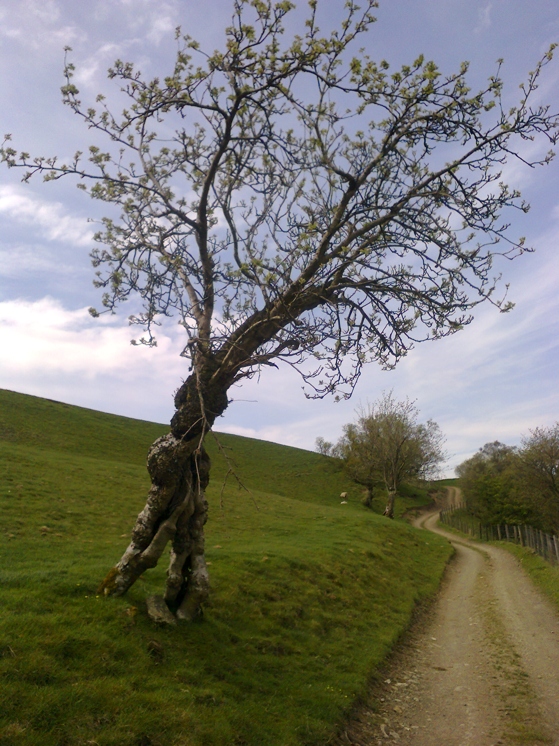
Prettiest Village in Yorkshire Dales
5th-12th June
Sadly it looks like the return to similar weather at the Winter solstice run up, with floodageddon all over again.
Hopefully I am SOOOOoooooo wrong, but I don’t think I am…………….
Lowlands/valleys and river ways, misty and hazy during the daytime and fogs developing at night time.
Flash floods keep on coming and if you are in an area outside of NW and SE Scotland and Eng then you might escape the worst of the very wet weather. Flash floods to Western parts at the beginning, move to NE parts see 10-12th
5th as before with heavy precipitation moving around the UK migrating up through northern England into Scotland by 6th W Yorks sees some better weather after rain subsides by evening.
6th Temps reach seasonal highs, but there is a lot of humidity around. Mists may hide sun till mid day.
7th Looks like a better bet weather wise with some sunshine and warmth
8th turn of the day sees heavy rain again but by breakfast onwards sunshine with cloud around, but muggy
9th Sunshine and cloud, south easterlies keep it a bit gloomy but some gusty spurts of westerlies move it along.
10th-12th Looks reasonable for W Yorks but flash flooding to NE Scotland/ England North Yorks too keeps things sombre
12th turns into a nice Spring day…aha if only summer were here…..don’t worry it is coming…..

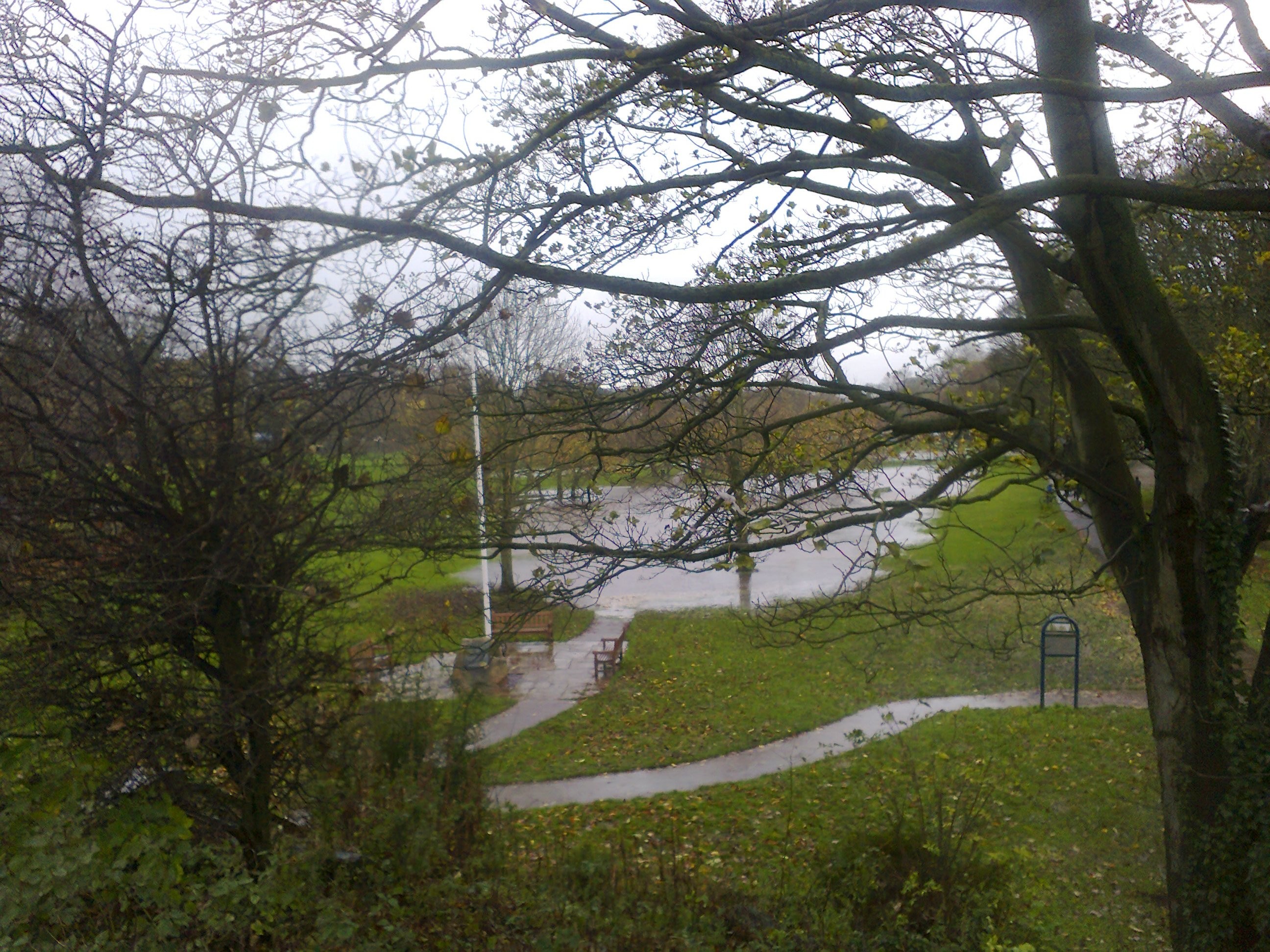
My Favourite Place Friar’s Crag Walk
12th-20th June
I expect more flash floods due to heavy waterlogged areas continuing to get heavy flash downpours NE Scotland/England Northern Yorkshire, Cumbria and Wales from the outset. rivers overflowing and flooding roads and routes in valleys flooded too….all good fun if you are wearing wellies, but not if your home is flooded again, so a great time to book a helping hol with those who are worn out with water…..
Some strong winds along narrow corridors and in high places with likelihood of wind funnels and I expect some tornado to West Midland region around 18th.
For W Yorks and Yonder the 13th June is wet for us around sunrise but for days after it will be very windy with gusty westerlies operative and W Yorks moves towards the solstice on 20th with better drier weather but Summer is coming in on a boat, just like the Egyptian Rah, so expect more stormy waves as the sun rises above the equator….what will summer bring I wonder……
WINTER WEATHER W YORKS N YONDER 2016
 Winter 2016
The lookout at this stage of the year end of 2015, time of finalising the forecast, doesn’t look good for the NW and Cumbrian regions where mists, very high humidity and floods may still be causing a damp and chilly surround.
The year starts Wet Wet Wet and looks set to continue the trend along with auguring some lower temps for the rest of the year to
come………camping may become a thing of the past…..for few years at least.
16th-24th Jan is a very eventful phase with headlines of EQ, pollution and mud/land/snow slides. Beginning of February is a bit challenging, but 10th Feb is great for outdoor pursuits.
22nd Feb-1st March look more settled with the planet Jupiter warding off any nasties out in the Mid Atlantic.
9th March onwards is a phase to watch for due to a return to conditions seen 3rd Dec onwards when weather wars broke out fostering many floods. While circa 6th March is very EQ sensitive.
This reminds me of old interpretations of ancient books that morphed into ”and prehistoric man worshipped their gods” …..errr……..of course enlightened people without prejudice or hidden agendas know the correct translation is ”they studied the planets. ”Astro mets use the ancient science of satellite technology to produce their forecasts long range, as done since Paleolithic times on antler bone, and highly honed in Sumerian and Babylonian times, then by Kepler and subsequently by intelligent long range forecasters such as McCormack and Pearce.
 2nd-9th Jan
The final throes of 2015 will have seen roads with the usual rivulets forming in dips, drains and culverts yet again belching under the strain, and brolly and raincoat sales rising.
The first half of this phase has some strong but variable winds around but also mists and mizzles to add to the mix.
2nd Sees temps trying to get milder but breeziness offers wind chills. Mists and mizzles around with fogs, thicker mists to the west of the region, cloud around once the mists clear away
Mid morning seems to be slightly clearer but some showery outbursts arrive by 4pm into evening with sudden winter showers, sleet and hail. Mists may turn foggy if you are travelling beware. This trend continues into early 3rd
3rd-5th brings in some spurts of whipping gusts and more lusty showery outbursts into the evening with a gloominess beginning to roll into cloudier skies. Sporadic Gustiness increases on 4th and it is the 6th when this dies down. The north is much cloudier than the south of England and some stormy turbulence likely for northern UK over next few days.
6th-7th is less unsettled though some breeziness prevails. Showers follow early mistiness, mid day on 6th, temps seasonally mild leading to gloomy outlook on 7th and sudden lowering of temps high in atmosphere for frost even snow on very high ground, some sloughing downhill into valleys.
8th-9th clearer skies around 2am on 8th wont prevail, giving way to some easterly flows after mid day, bring in chilly damp conditions promising winter showers of rain turning to sleet and snow, very heavy to far west and north and in Dales, and on high ground such as Pennines so take care on the roads, snow will also expected in W Yorks.
 10th-16th January
10th could see strong winds off W Ireland coastline but these are travelling westwards, and on 14-16th Jan this system is also operative.
Snow could still be covering some ground around W Yorks and yonder from the outset, but with temps getting colder it can turn frosty and icy as the days march onwards.
Some variable conditions but it does look like we get a few good days 15-16th while a storm is brewing out to sea.
10th Mists/mizzles clear by 8am onwards, some blue skies with cloud developing in mid pm, but remaining fair into the evening with any rain arriving to NW regions around 10pm, travelling east.
11th Similar to 10th though some precipitation potential mid morning, breezes wafting residue showers around, cloudier by mid pm, flurries expected as clouds that bring them form.
12th Sporadic hail and sleet from midnight intermittent into early morning, cooling temps and flurries on high ground keeping things cool, more sporadic outbursts/flurries during evening towards late at night. Rainier to NW regions from around 10pm. Winds stronger on high ground.
13th Clouds/ mists in valleys to start the day, which turns duller by mid morning with potential mizzles mid-day. Snow on high ground could drift down on wind but overnight looks clearer for better overnight conditions.
14th Any precipitation seems easterly of our region, some ghoulish winds haunt chimneys and alleyways, cloudy but fair day expected generally.
15th Storm breeding will be headlining today for areas out to sea. Inland looks gloomy with short sharp cutting showery outbursts from 1am onwards. Today and tomorrow should see some finer weather to enjoy with gradually clearer skies and undecided but strong northerlies trying to see off some of the gloomier weather.
16th May bring some sporadic intermittent fast and furious showers, mingling with winds, with frost to high ground early morning, and possibly lingering during the day, along with cooling temps and mists to valleys overnight as cloud grows thicker. Expect colder winter temps from now on.

16th-24th January
There are three major events for this phase. One is land/snow slides, the other is seismic affecting our region but also longitude from Brighton through Grimsby and northwards, 20th-22nd, my money is on 22nd, and the other is air and land pollution from the onset arising from widely fluctuating weather extremes and drilling activities–gas and deep cavernous rock minerals are likely to be actively triggered causing hazardous events.
Communication lines will also be at risk as well as transport routes where ice, blizzards and harsh weather breaks out.
Landslides expected to Komi, ASSR, Russian federation area 17th-19th, some seismicity affecting the area too.
Air pollution coming in from the east is highly likely to impact on health in W Yorks region.
16th As above some westerly battles with gloomy easterlies. Clear cool and crisp outlook.
17th Snow flurries likely around 6-8 am, mid day and evening; winter showers heavy to NW with rain sleet or snow in the mix, and travelling our way possibly overnight into 18th. NW Scotland could be seeing unsettled weather for seagoing.
18th A mixed bag will create problems with milder low lying currents overlaid with colder higher air strata, so in valleys expect milder temps but on high you will feel the cold coming in, and frostiness. This is a combination of freeze and thaw meeting and sudden thawing to soil can create slide hazards, snow or mudslides on mountains and moors, Pennines and cliffs. It all depends on altitude of regions affected.
Conditions established today also affect gases and other minerals underground.
18th into 19th Erratic winds NE and SE circulate with routes affect by blizzards and either rapidly thawing or rapidly freezing surfaces. Communication and power lines in Eastern areas can also be affected as blizzards begin to take hold.
20th Is very icy with blizzards continuing on high routes and to the north UK affecting comms mostly and exposed transport routes, but some sunshine may break through the mix up, the sun laughing at earthling folly! Ozone rich atmosphere operative today.
21st, Mists mizzles and gloominess freezing fogs at start of day, with spurts of icy hail and winds driving in sleet and sporadic winter outbursts till after midnight tonight. Today sees temps dropping low brining an icy cold day.
22nd Is when I expect seismic offerings so will be tracking where the EQ affects UK landmasses. Air and land pollution high today, so take care when out and about. Heavy winter showers expected to fall across mainland UK take care if travelling or check your air or train availability due to disruption over past few days.
23rd Freezing mists and fogs in high places, but less wind and more settled outlook ahead, with temps levelling out from icy, icy temps. Some clearer skies to help us feel less assaulted by weather dramas.
 24th Jan – 1st Feb
Very cold, frosty time ahead, some icing on exposed watery places, but temps will get milder as this phase progresses. Some dry days with sunshine around, clearer evening skies keeping things cool, unless otherwise forecast.
Likely days for winter showers are 25th around 6-8pm when showers with sleet and snow and hail can race around. 28th sees a fair start with snow flurries around mid afternoon but 31st looks like being the worst day for rain stopping play but this looks like happening late evening around 9-11pm, and could continue into early next day.
Winds more settled, less blustery till 27th when they get gusty but a good day for drying out anything that got drenched.
EQ aftershocks may reverberate around S E seaboard US 25th or 30th Jan likely dates. The butterfly effect, cause damage in one part of the globe and see it affect another part………………………..
Mists, high humidity and cold damp air, though less cold by 30th when southerlies bring in some promise of more weather battles to come.
31st seems to potentially bring in more blizzards.

1st -8th Feb
The stormy nature continues but temps eventually less cutting by 6th. EQ potential again 2+ or – 4th, haven’t time to see where this is likely to be…east of UK suspect longitude 25 E
1st-2nd is full of blizzards intense from midnight to mid day with power lines and air traffic affected. the system begins off NW sea areas of Scotland and slowly moves SE over next 2-3 days eventually fizzling out to East sea regions Gales to high spots affect air travel and routes and comms. Gusty spurts lashing any prominent landmark. Worst of weather should ease after mid day 1st, but start up again early morning to mid day on 2nd, which will be a very unsettled outlook with winds of gusts at varying speeds, bringing in rain sleet and snow to high ground. Temps cold to freezing depending how exposed you are. Winds dying down on 2nd but evening could see potential residual precipitation.
3rd Low temps prevails, some cloud and sunshine, breezy. Cloud thickens by evening with potential for sporadic isolated sharp showers.
4th Weather systems move quickly eastwards so varying cloud, sunshine, fair and not so fair scurrying along. Some blue skies to enjoy with sunshine in the mix. Overnight into 5th could see some static outbursts.
5th Chilly start, gusty again, erratic sudden spurts, some static lightening may also arrive in the morning, with sleet or hail outbursts, mostly localised in micros.
6th-8th Northerlies are active now trying to clear the weather away some spits or spots around blowing in the wind but generally a fair outlook expected. 7th more likely to see more winter flurries arrive before mid day with snow in the mix, snow settling on residual frost likely. Winds can be active but not so strong as earlier in the phase.

8th-15th February
Winds are less active though any breeziness will contain a chilly feel. Northerlies are moving westwards warding off some of the worst of the weather out in mid Atlantic and iciness attempting to come down from Iceland, so we can expect some fairer weather to generally prevail. If you’re organising outdoor pursuits the 10th is a fantastic day to put in your diary—pay me later…
8th Sun with cloud expected during daytime. temps colding (yes I know its not in the dictionary)
9th is cool and fair with varying cloud but heavy winter showers expected to the west around10-11pm
10th Could see the heavy overnight winter shower coming over our region before the day breaks out into refreshing and fine outdoor atmospherics. Wind chills but exhilarating, very pleasant.
11th temps seasonally mild should still be fair conditions generally.
12th Cold temps with occasional isolated sporadic short sharp showers pm and late evening
13th A chill factor and a little bit clammy with mists and likely breezes could turn windy with aloft air chill factor.
14th This looks like either snow or sleet around in our region from early am not sure, sorry…might even be mists lingering but with humidity around during the daytime.
15th ongoing……………….

15th-22nd Feb
This phase sees temps growing colder to frosty but mostly uneventful headline weather wise. 15th-17th mainly dry some clouds around and southerly flows, so any precip forecast is expected to be light.
15th early am could see sleet and rainy spells heavy to the west snow in the mix at the start of day slowly travelling our way, skies clearer by 4-6pm but chilly conditions moving in late evening
16th showery before sunrise mists and mizzles potential some cloud around but mostly dry during the day.
17th similar outlook to yesterday though snow bearing clouds look to get heavily laden
18th breezy chills frosts but some blue sky with sunshine around, fairer southwards cloudier to north with southerly flows
19th Fair but nippy outlook mists and fogs to valleys and low lying roads by late pm and overnight, freeze fogs potential
20th Looks like blue skies around with sunshine but little warmth freeze fogs by evening again.
21st similar weather as previous days some static hard hitting showery stuff circa 7pm
22nd I expect sleet snow and rain to arrive and move across many regions of the UK today, potentially southwards around break of day but moving around. W Yorks looks like being hit circa 8pm Mod to heavy precip expected.
22nd Feb-1st March
The worst of the weather stays in the Mid Atlantic for a while longer and this looks like being mild, with 28th unusually so for the season.
22nd as above with 23rd less likely to bring rain.
Without delivering a blow by blow account, I expect seasonally calmer trends with little precipitation or disturbance. Some cloud around but also some sunshine. 24th looks a little lively with gusty weather 25th is fair for the north with fast moving weather taking any rain threats away, 26th is blustery with erratic gusts, but mild temps, 27th is cool but clearer skies, varying winds with cloud scurrying along, thickening later into potential misty conditions near valleys and low lying routes.
28th will see mists and fogs in the evening and sun could find it hard to break through haziness during the day which will have very mild temps for a winter season.
29th still some mistiness and fogs but greater expectation of them clearing during the day
1st Cool fair weather could be disturbed after mid day by showers
 1st-9th March
Seismic intensity magnifies around equatorial regions of Indonesia or of equatorial region of South America for this phase. 2nd -6th March above 5 mag expected.
Some mists, fogs or snow could be to the west of us but the outlook is eerily calmer than expected for this time of year, unless I missed something major….the calm before the storm perhaps however, here goes
1st is cool fine and fair some cloud around but nothing to worry about, and late evening skies look very clear indeed pehaps inviting frosts to form and mists.
2nd is similar to 1st but potential for showery outbursts around mid day, sudden sporadic and intermittent spells.
3rd Looks like a very nice day with a clear atmosphere for those with a camera
4th-5th again nice outside but some blustery whippy gusts beginning to get active
6th is disturbed and a little unsettled but by mid day again things should look good.
7th sees winter hail sleet and snow coming over, may be heavy at times, heavier to the west but travelling our way too arriving potentially circa 9 am
8th full of mists and fogs or haze so it will be hard for the sun to get through…could be mingled with some pollutants as well
9th-15th March
This looks like weather Armageddon when the weather shows us who is in charge, and it isn’t flood defences or other man made attempts to rule the globe! Weather alerts galore expected. Cyclone breeding off NE coast South America adding to turbulent Spring Tides expected to bring dangers to sea off Northern coast of Scotland and Orkneys breeding gales, within first few days, travelling to SE Scotland into North England and downwards .
Similar conditions to first week in December 2015 are set to break out. I often hope I get predictions like this wrong, so here’s hoping I am.
Blizzard territory likely to break out this phase….
This is a total solar eclipse with perigee Moon on 10th, so we expect some wild and extreme weather to come and continue. In December the world watched as floods broke through defences in Cumbria and many parts of the UK were assaulted by torrential rain, gales and landslides in Altura in the Highlands and at Ullswater, with gales across Wales and western parts to add to the spectacle.
Severely disturbed atmospherics continue, with record breaking outbursts expected, Lowestoft/E Anglia region singled out for
headlines–possible air and travel and sea disruptions but could also be lightening strikes, along with other parts of the UK seeing action hitting headlines.
The equinox isn’t far away and usually the heat of Australian summers get dragged up to clash with the cold of our winter breeding Spring in it’s wake. Spring with noisy labour pains.
Temps can be metal bending cold in high regions and as this crystallises it will drop down to meet the warm air travelling northward, often this results in tornadic breakouts circa 11th for W Midlands and circa 13th to some valleys as cold air falls downslope.
A quick tour of the drama begins with unsettled outlook for 9th-10th, showery outburst expected, but some fair weather possible during the day, though to the west there will already be signs of winter showers. Static outbursts expected
10th-11th The worst of the weather comes overnight 10-11th and looks set to migrate around the UK with record levels of precipitation as well as flash floods breaking out as the sleet, snow and rain circulates, W Yorks in the firing line for this event, as well as other regions. Fogs and mists highly likely near sea and valleys and watery areas.
Rivers and other watering places in low lying valleys expected to flood plains and beyond, so collect your cattle, and keep vulnerable creatures and people safe over next few days as well.
12th looks set to bring in some breezes with some milder outlook but humidity high with more wintery outbursts potential sleet/hail during the evening.
13th-15th Some isolated narrow storms travel through valleys with tornado potential to Midlands, air transport affected as well as high routes across Pennines and traffic on bridges over estuaries, as scattered electrical storms move around. There could also be news of more mudslides. Precipitation expected overnight 14-15th when mugginess and mists and cloudy conditions prevail.
Very strong northerlies around by 15th trying to clear away the mess King Weather has ruled us with. Tendency for cold miserable bouts of sleet, hail, snow and rain with valley areas feeling the brunt of high levels of accumulation……..
Rivers and other watering places in low lying valleys expected to flood plains and beyond, so collect your cattle, and keep vulnerable creatures and people safe
15th -20th March
More furies to contend with as a stormy outbursts hits from the West to NE GB, gale force winds arise strong and northerly, seagoing affected and major routes and air travel disturbed by this trend. More heavy precipitation coming in as the northerlies, often high speed and fierce, try seeing off the stormy weather. Western parts most hit with disruption to air, sea land, rail. Gales around from 15th, hurricane likely to rage in from the sea—-destructive by 16/17th., 18th might be more settled but not for long while 19th is very cold and windy with northerly chill.
The Equinox is early on 20th disturbing conditions further and sudden falls in temps partner a cold front descending from the north with sudden abundant rains to watering places in valleys overstretching capacity in rivers, on roads and low lying pathways and routes…….mass floods heralded.
Spring arrives with a grand entrance letting everyone know hell hath no fury like a global climate on the attack

Time to think of those wonderful summer days ahead…………..
UK WEATHER BRIEF SPRING 2015: Long Range Weather Forecast W Yorks and Yonder

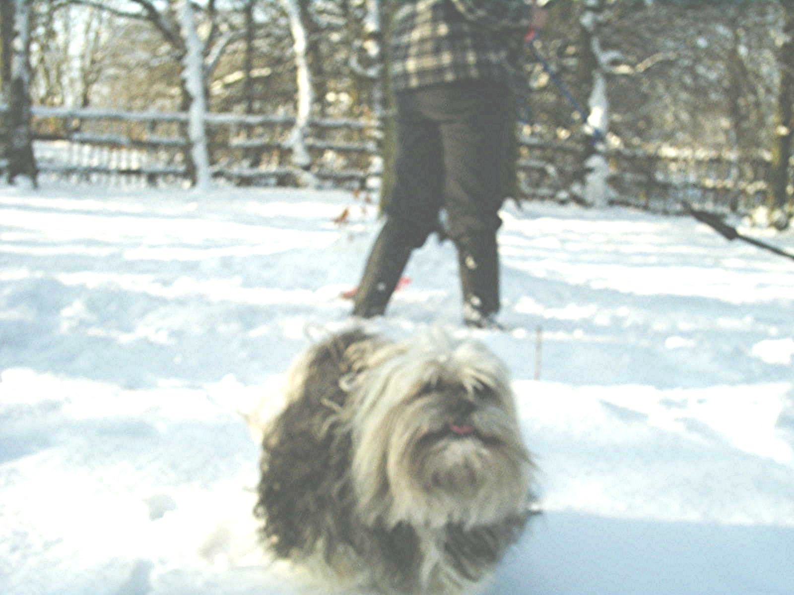
Best dog ever
First of all apologies to those people who have signed up for regular reading, life and the universe had other plans for recent seasons.
I can’t promise normal service resumed, but promise I will make every effort to do so as it would be reckless to ignore years of skill developed by using astrology to forecast weather.
I can’t promise 90%-100% accuracy for this forecast as I know for sure I abandoned looking at the wind charts settling instead for expedience and using indicators in the other charts instead. I do expect 60%-80% and for sure some weeks may even move towards being 100% accurate, and I do hope this will be the June part of the forecast which will bring in some fine weather if not a flaming June living up to normal expectations.
Spring Weather 2015
The New Moon on 20th March reached perigee on 19th so is not quite a massive headline supermoon but will bring some unsettled weather as this is also the day of the equinox, and the sun rising into the northern hemisphere along with the moon we will see some fast moving weather systems, so don’t expect sunshine or rain to stay around for long. However, this perigee is quite long lasting as some of my weather buddy friends point out (noteably the ever watchful Ken Paone) and Robert Nolle calls it a ‘stealth supermoon’ due to it forming an eclipse while perigee lasts from 13th-27th March capturing the equinoctial phase.
Not only that NM being at the end of one sign and ready to move into another we can expect trends to vary quite dramatically from the outset. The last time we had a New Moon at this stage of motion heralding Spring, was 1996, however this wasn’t eclipsed. I failed to find any records of weather drama for the UK, which is not to say there wasn’t; just that most websites I searched had headlines for other months and years than this. I do expect some spring tides to be wary of at coastal places, with sea frets and mists more to the east coast, but if you like the spectacle of sea horses and crashing waves the coast is where you need to be for this these few days. An eclipse can often nullify expected outcomes, whilst a perigee Moon can often exaggerate them, whilst a planet moving from water to a fire sign can often bring spectacular results all on its ownsome. Certainly the Sun cuspal for the equinox on 20th will bring in some static atmospheric turbulence and with the Moon in tow this indicates mists and fogs.
I’ll be watching the eastern central Philippine area to see if a hurricane arrives there around 20th-21st, but it will be fast moving and short-lived.
Here is a brief tour only:
 20th-27th March
20th Very unsettled with one weather system soon replacing another in quick succession: cloudier if not gloomy to some areas by evening, and some nebulous wind flow.
21st Wetness seems to stay to the west of us, though some may blow over to parts of W Yorks, with some hail and sleet showers rapidly arising then stopping suddenly as it began, more likely to south of England, but in fast moving pockets. Usually weather like is accompanied with sunshine, but this can soon be overtaken by cloud as well so any sun spells may not be long lasting. 8-10pm could also see more outbursts as described. Some cold whippy northerlies and westerlies could be attempting to clear way the unsettled weather from today.
22nd Clouds around, humidity hints at warmer temps, clouds and mist by late evening.
23rd Some warmth could break out today but humidity rules so misty pockets could spoil visibility, especially at the start of the day (this means at the turn of day around midnight onwards beyond 1am) so take care whilst travelling throughout Yorkshire and beyond….Some cold pockets out of the sun where breezes wind around corners and some cloud around.
24th I expect some showery outbursts today evening the likely time centreing around 3-4pm. Mists and clouds rule especially denser to the east regions, Spring April like showers highly likely so don’t take a sunny spell for granted. Still some warmth around so a heartening trend for gardeners with bulbs enjoying the weather. I also expect some whippy westerlies to be active today, more so to the NW regions.
25th Cooler temps sun with cloud around, micro hail and sleet outbreaks, particularly in the evening, interfere with sunny spells.
26th NW winds in spurts bring in icy temps to high and exposed places, but ensure clouds get blown away faster leaving a promise of sunshine as well……………………but not for long……………………….read on
 27th March to 3rd April
Rain over the West will slowly, oh so slowly, beginning to move into West Yorkshire from today and will bring some heavy outbursts which will leave roads flooding as it moves on. I expect parts of Cumbria to be vulnerable to this from the 26th, as well as some places in W Yorks where rivers and lakes and flood plains will be witness to the incoming deluge. Ireland, Wales and Western Isles of Scotland will also take in this system from the outset. The East of use fares slightly better, but rain will travel in their direction by 28th when it is heavier to W Yorks before moving east.
Winds will still be keeping temps cool on high or exposed areas and will be quite brisk and Nor westerly
The 31st sees off the worst of this slow moving system but is still unsettled, while the 1st is calmer in outlook with no surprises weather wise, and the 2nd brings cooler conditions to E Anglia but fairer weather to the north, some easterlies threatening to spoil things again with a bit of gloom and some unsettled winds around, but by evening the sun is beckoning and promises a better day to enjoy for 3rd….enjoy……………..a lovely Spring day at last.
4th — 12th April
Some migrating lightening and t/storms likely making it difficult to positively locate them without taking a long time, but they can be expected during daytime rather than the night. Eastern parts of UK, East Anglia especially will see a lot of this type of weather.
4th potential showery outbursts by mid day with sporadic hail sleet type outbursts in some pockets of W Yorks during mid afternoon, so sunshine in between these outbursts. Eastern UK could see some of these outbursts
5th Rain likely to move down eastern coastal areas, dry to W Yorks but cool, very cool and lots of static around. Some occasional sun spells
6th Thunderstorms look likely mid morning to North, South and Eastern parts of Britain, W Yorks may get some inward moving systems but for us this clears by 1-2pm when sunshine and better weather should break out. North Westerlies strong and active but will hopefully take away the static stormy breakouts.
7th Cool day with some sunshine around but NW winds are strong and cutting, on high ground and coming downslope so watch out when travelling in valleys where wind tunnels can create problems.
8th Cold day with some cloud around , winds are still active keeping things cold but blowing clouds away to leave some gaps with blue sky coming through. Unsettled outlook by evening.
9th Much better outdoor weather today temps can be warmer than previous days
10th Cool but sunny with temps warming up. Winds could prove lively and highly excitable at times.
11th Should be a better Spring day with some warmth around come the 12th ……………………………………

My mum is so going to miss me this time of the year
12th-18th April
A generally fair but blustery phase, overall cool, breezy just about says it all, but there should some sunshine around too with Spring warmth for first few days.
The winds excited on 10th may continue to affect NW regions which could encounter comms and transport probs, while from 12th-14th hail sleet and snow outbreaks to NW Brit regions could see snowfall on highland areas.
12th Cold start; warmth from Sun by mid day and afternoon. Some mists could arise near watery places. Temps rising with southerlies.
13th Warmth around mid day and pm, but this could trigger a quick shower or two mid afternoon scattered and intermittent until before sunrise on 14th. Some mists also due to warmth creating moisture.
14th Some dampness remains but temps mod for season and some sunshine could break out between clouds, with potential for rain after mid day.
15th Cool, breezy and cloud around, easterlies bring in some gloomy conditions, lowering temps.
16th A slow moving weather pattern with clouds around, lower temps but it will be fairer to areas to in North and South Britain. Some gentle southerlies around too.
17th A fairer outlook for today.
18th-25th April
Temps look like being seasonally lower range for us, but down in Aus they could be battling the usual treetop fiery outbursts so watch the weather news for these headlines……
Overall drier weather should prevail until last two days, with some good spring-like days emerging, notably 21st- 22nd when ozone highs should keep everyone happy, so try get outdoors for the spring lift, but wrap up warmly…..
18th Southerly flows, some sunshine to enjoy during the day but by mid night it looks like some scattered stormy outbreaks stop play outdoors.
19th A few micro showers around breakfast time and again by teatime 6pmish but some sunshine in between but remember temps will be lower than usual, though some warmth from the sun at mid day onwards.
20th Should turn into a lovely spring day, a great day for getting sheets dry but watch out for those whippy keen westerlies if you are kite flying or ballooning..
21st The ozone highs arrive so expect a sunny day; cold, if not nippy, but great for outdoors. Northerlies keep things cooler but fresher.
22nd Winds northerly then whippy westerly and pretty speedy by late evening could be lively but at least they keep any clouds from turning things grey……..but
23rd-24th are the days when rain may arrive to spoil things heavier to mid day on 24th when it should subside…temps lower still to that of previous days.
25th April-4th May
The eastern coastal regions look to be enjoying some sea mists due to getting the best of the sunshine from the outset with E Anglia getting what highs of Spring are operating, but it should also be reasonably spring like with sunshine to W Yorks at the start. Temps fresh and moderately Spring like with some improved temps by 27th, but not for long….
25th-26th Sudden air frosts but generally fair, sun with cloud around. Good for photography so get the camera ready
27th Sees better temps slowly arising along with less cloud
28th Some mists or cloudiness bring potential for showery outbursts, here by around 7pm
29th Cooler, sun with cloud and mists to watery areas
30th Fast moving system now, with showery outburst potential before sunrise over next few days, clouds and mist around to western areas so don’t expect too much sunshine to stay around today.
1st –3rd Breezy, cool Westerlies argue with Easterly flows unsettling the atmosphere and allowing for some gloom to slowly develop over next few days. Frosty with intermittent hail or sleet showers in between sun spells leaving it cooler but with sun around by 3rd.
My Favourite Place Friar’s Crag Walk
4th-11th May
This phase doesn’t look good at all. Weather headlines for Cumbria expected, generally most of Britain will not enjoy great conditions. Conflicting weather systems leave things very unsettled from the outset with clouds and winds keeping the sun at bay. Temps stay below normal range until 6th when things can warm up, but this may just trigger mists and mizzles afterwards.
4th Very unsettled outlook develops and prevails over next few days with gloomy easterlies arguing with westerlies, and ain may result, heavy at times.
5th Could see stormy outbursts with NW regions getting the worst of the weather, clearer by evening
6th Better day after a misty cloudy start cool but some blue skies around with breezes keeping temps cool.
7th Some warming of temps today but clouds around, mists develop later in the day near watery places
8th Some rain expected around sunrise, if not continuing sporadically from night before. Cloud around not sure if the sun will get out today.
9th Skies should be clearer temps less harsh but winds variable with intermittent sharp, scattered showers expected along with sun spells
10th Looks like the better weather is on its way………………..read on……….
11th May-18th
Not a very good outlook with some turbulence still operating though East Anglia looks to be the lucky part of the UK with better conditions augured. Temps still staying below seasonal average but the heavy rains look to be behind us for this phase. Less sun to enjoy than we would like, and we’ll be left putting heads down and getting on with it. Still, that’s Spring moving towards a better outlook for June…hopefully….here’s a very brief tour for W Yorks region
11th Could be some scattered showers around, suns spells possible today
12th Mists, gloomy to western parts but westerlies are getting lively today so should help blow some clouds around leaving gaps for sunshine to come through.13th A rather bland spring day for us.
14th More unsettled conditions sun around with humidity developing.
15th Sun with cloud and winds vying with each other again.
18th-25th May
This phase begins with wet weather but refreshing the gloomy atmosphere of previous days. Still some unsettled atmospherics that can interfere with air traffic, but the last few days hold a hint of better days to come. The damp chill of former days might not be so oppressive this phase.
18th showery very early before or around sunrise, clearing by mid day if not mid morning. Northerlies argue with westerlies, expect some wind chills to remind us this is Spring not summer.
19th-20th similar to yesterday but winds get more active and keep things cool, less likelihood of showers breaking out.
21st The weather begins to warm up a little with expectation of sunshine for today.
22nd It will definitely rain today…really it will…watch for 1-2pm
23rd -25th Isolated cloudburst expected potential for news of tornado affecting Midlands as winds may get a bit wilder, rising temps however, breezy, sudden wind spurts but fairer weather slowly breaks out but this means mists can form and it is they that can interfere with flights.
25th May 2nd June
Don’t worry the good weather news comes soon for June, just watch it trying to breakthrough valorously during this phase!
There will be some mists around mainly eastern quarters, but also to valleys as descending cold clashes with arising heat trends, and some lashing westerlies may cause problems by 27th, troubling some to NW Scotland. The south looks to get the fairer weather but this will change by 31st.
Generally a good phase for gardeners to watch their crops thrive on the weather conditions.
25th Stratus clouds dominate the north with hail and sleet likely to sporadically hit pockets to the north, with highlands getting snow. Very cold on high ground with chills lowering temps as they fall leading to some mists forming to valleys, late evening as well. In between showery outbursts some sunshine could be present but these micros are difficult to track-probably valleys such as Ilkley, Addingham will get the mists while Grassington will see fairer weather.
26th A misty start with lots of cloud around clearing by mid day leading to cool but sunnier outlook
27th A fast moving system aided by some high speed lashing westerlies sunshine covered by clouds as they speed along.
28th A more settled outlook as winds subside with warmth from sun by mid day onwards HURRAH! Summer beckons….
29th Variable breezes, sun with cloud.
30th Some mists around early morning but clearing away later, however it does look as though some more rain makes its presence felt by evening so don’t take anything for granted when the sun shines.
31st Sun provides heat but forms clouds drying up any rain from previous day leaving cloud around for 1st which could stay gloomy, but generally the pattern from 31st- 2nd is one of a fairer
outlook to the north with temps lowering on previous days and some cloud around……..But oh look at 2nd June………book this for your day off and plan a mega outing……………….might even be a great evening for a barbie!
 2-9th June
This is the phase when you can get out the barbies, put on your best summer gear and plan for some great outdoors. The only blot on the horizon is some fast and furious sleet and hail and lightening storms raging around by 6th, like a petulant winter trying to stop summer from arriving. Expect both lows and highs with some areas reporting extremes for that day.
2nd Cool sunny day with warmth from sun pretty comforting by mid day onwards
3rd A lovely evening for sure, during the day some varying temps could see cold in shade and exposed areas but temps in sun in sheltered areas will be lovely
4th Fairer weather to north especially
5th some early mists as the earth warms up clearing the way for rising temps today, another lovely evening to enjoy outdoors
6th An all weather day with highs and sudden lows and some static around causing micro hail and sleet showery stuff, some lightening around too as micros circulate inland and to lowlands.
Take your brolly but don’t expect outbursts to last long, it’s a war of the weather but summer wins! Records could be broken today weather wise, some localities could end up with misty stuff but don’t worry it wont stay around long term..
7th onwards some lovely highs can now rule with fair summer weather and higher temps to enjoy though on 9th will be interfered with by whippy, cheeky, gusts and spurts of Nor westerlies.
9th-16th June
A very quick tour of the weather for this phase brings in seasonal record breaking highs by 11th-16th. The East looks set to be where the best weather of all is, the west could see a little more cloud, but overall this is summer at last with sunshine to enjoy.
Overall expect wholesome weather great for outdoors and smell the ozone. Scattered clouds, blue skies and perfect days to enjoy
9th-14th sees southerlies around while the 9th is a glorious day, the 12th could see some scattered precipitation on 12th, the 11th sees a real ratcheting up of temps with some isolated hail shower potential to some pockets mainly east late evening.
14th-16th potential for some breeziness turning NW but at least it keeps Mr Rain from spoiling things.

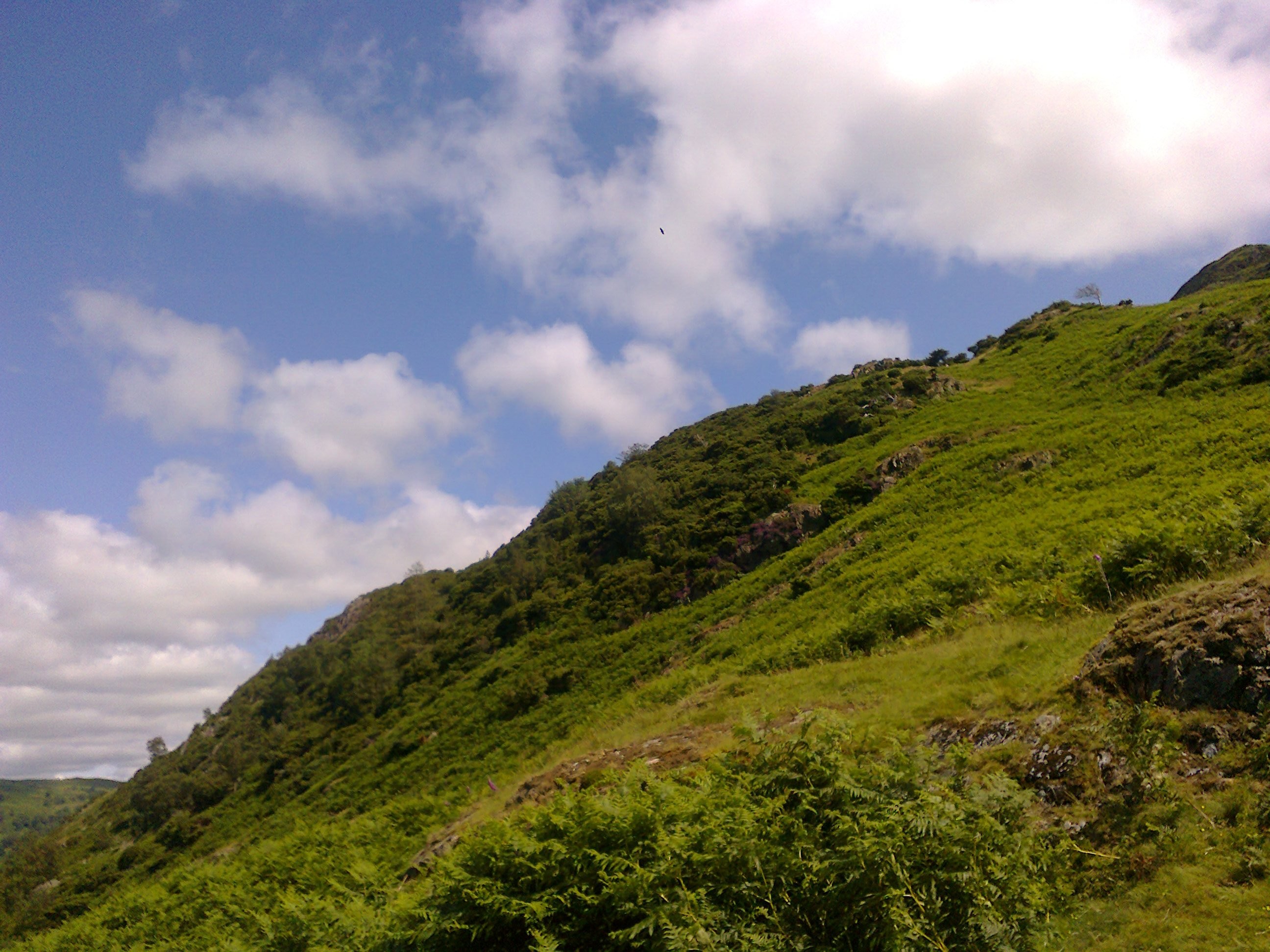
Aaaaah Summer days
Summer Solstice phase 16th-24th June
Slightly more cloud for us this last phase of Spring, but overall we can expect some fair weather to continue along with seasonal higher range of temps. Some breezes could keep things seasonally cool by 19th as the sun gets ready to rise even higher in the sky which of course always brings in some disturbance as we enjoy all those squelchey wellies around
Glastonbury…they might get drier ground this year!
On 21st, solstice day, we can expect a little cooling with some cloud playing with sun spells around mid day, breezy but overall fair weather to enjoy.
Records for the East GB expected.
Spring UK Long Range Weather Forecast W Yorks and Yonder 2013

Spring 2013
Spring UK Long Range Weather Forecast W Yorks and Yonder
Cold and wet with snow thrown in just about sums up this Spring season.
Spring is late arriving this year and will be characterised by some strong if not fierce windy outbursts watch out for such conditions from 18th- 25th April for wild conditions to reign. This phase is also the best temperature wise and a great time to book a holiday in Ireland where it looks like the highest temps will be reported.
25th April to 2nd May looks like a slow moving system coming down from a low to NW region moves slowly across to the east spoiling the outlook a little but manifesting the continuing clash of highs with low and producing some high humidity and pluvial conditions along with mists and hazes.
June doesn’t look very flaming this year with some reminders of last year Jubilee conditions returning to haunt us and floods breaking out as rivers come full capacity creating flood alerts predominantly to the east and SE by 16th June, but the western parts are also under assault from heavy moisture mist and fogs hanging around some of those parts for weeks at a time prior to this.
Very unsettled conditions for this phase as Spring tries to break through, with some unseasonably cold conditions prevailing.
Mists and fogs to watery places will form as warmer temps try to ward off cold descending air masses, with mists and squalls more prevalent to the N East.
Very strong if not gale force winds arrive by 22nd with tornado breeding conditions likely to midlands SE regions.
Winds are very sporadic from 22nd onwards, strong at times and we will see transport systems affected as well as communication systems.
19-20th March unsettled weather with cold temps, potential frosty outlook and southerlies and NW air breeziness brining in some intermittent showery outbreaks localise with hail and sleet coming in and snow potential for high ground.
21st Cold day, some sun but attempts at warming by mid day, quick icy showers could ring in the start of this day.
22nd Very unsettled with sleet, hail and snow blizzards potential, the south looks to be worst hit by precipitation at this stage. Winds more lively becoming strong and gusty with tornado breeding conditions to S E Midland areas. Very strong winds to our region by 10 pm with blizzards likely to come in overnight into 23rd accompanied by high velocity winds t/out UK and some scattered electrical storms. Transport and communication systems upset by this outburst of squally weather. Areas between 30-40 degrees over in Europe also look to be having some fun with the weather at this stage.
23rd Very cold outlook, mostly cloudy, some sun attempts by mid day, sporadically strong winds continue with mists and fogs around late evening.
24th Spring makes another try at breaking through today, arriving later than usual. Some windy conditions stay around, outlook very unsettled, static conditions are lively so quick sporadic localised showers can be expected as the day begins particularly. Clearer skies before sunrise with some milder temps attempting to ward of the nippier ones ruling previous days. Mists and fogs near watering places as a result.
25th Clear skies to start us off a dry day with cold pockets but some good conditions for getting outdoors and flying your kite in the windy weather! We should see lots of sunshine along with some cloudy stuff. HURRAH!
26th Weather systems begin to move in an S E direction a cool sunny outlook with some cold pockets to contend with.
27th Looks more static and some electrical outbursts expected…difficult to locate these sadly…..read on…..
27th March-3rd April
Tricky chart to read with many hidden and unusual combinations of weather systems, so I’m not very confident of the forecast at this stage but here goes……
Previous combinations of the type we meet this phase arrived last year when mudslides affected the N E regions near Berwick upon Tweed and Hexham whilst down in East Anglia lovely summery weather broke out, though some spray did arrive to interrupt clearer conditions than those upsetting rail routes in other areas from 26th June.
News of mudslides not beyond the bounds of expectation…oh if only I had a team of workers I could be more specific…….
Not only that another similar outbreak of bad weather hit us in November 2011 when Stonehaven in Scotland got a 100 year record broken as floods broke out whilst in Hampshire mini tornadoes surprised a few folk.
I do expect some flooding for this phase and it does look likely to be the N E regions again, but hopefully I am so wrong you just ignore this forecast…here goes……..
27th Heavy rain looks likely to be travelling eastwards from the start of the day (start means after midnight) but we can also expect temps to rise today and dryness to prevail as day draws onwards with northerlies active trying to dry everything out and blow away the poor conditions……some Seismicity around last time this occurred it was Cumbria region….
28th Dry but cooler day some warmth from the sun by middle of the day when sun is stronger, but some cold pockets around especially in high exposed places, Cloud around late evening.
29th Broody outlook today if not oppressive, could be some sunshine around but again cold pockets keep things cool in shade by late evening, clouds forming could bring in some prolonged precipitation that lasts far into the night and into 30th…I am not dismissing flooding due to strain on drains and it looks like north and n eastern areas already pointed out in the intro that are vulnerable….
30th as already mentioned some sunshine could break out but some loud around also clouds if not mists by evening or it may be frost as well…..
31st Better outlook for today sunshine with cloud, milder conditions but sun manages to warm things up for the afternoon a little bit.
1st April Warmer or milder seasonal temps expect these to go up today…..
2nd Some precipitation to eastern quarters could be off shore Brid, Scarborough and Whitby….hope it isn’t Whitby under assault yet again….cooler temps sunshine around as well, some gusty weather to contend with also.
3rd read on as this looks quite changeable
3rd-10th April
Looking back over my weather history the last time we had a chart similar to this over the past four years was April 2009 when Mars was on the equator and whilst the temps were spring like and warm there was a lot of heavy rain and thunderstorms broke out to Leicestershire and beyond. Similarly January 2010 when icy temps reigned with arctic lows coming over, a lot of precipitation arrived along with thunderstorms to the Huddersfield and beyond regions, with floods due to thaws with Scotland hit badly by fogs and mists causing chaos.
This leads me to understand that we will get fogs and mists this time around, along with heavy precipitation in the form of wintery showers, hail sleet and snow very heavy amounts expected sometimes localised but t/out the UK by 7th possible overnight from 6th so prolonged and causing problems in its wake, with thundery outburst localised around 5-6th.
In brief this phase is cold, damp, misty, wet and windy……………………….potential for tornado or wind spouts for 5th-6th
3rd Gusty westerlies still around from yesterday with potential winter showers by afternoon
4th Cooler outlook, some sun southerly movement of weather quick sporadic showers by afternoon, localised so difficult to track.
5th Intermittent sporadic fast icy winter showers, heavier by evening, temps slightly milder. Some mists and haze developing near watery places due to cold and warmer air clashing and wind spouts potential to SW in Midland areas–more likely on 6th>>>>>>>>>>>>>
6th Isolated showery intervals broody conditions with humidity high giving potential to breed mists fogs and haziness, this looks denser to western quarters. Southerlies bringing in snow or winter showers with N W regions up to Scotland getting heaviest outpourings. The precipitation could last overnight into 7th
7th Winter showers throughout UK with some snow expected, very heavy at times and causing traffic upheavals, some regions could see flooding.
8th Sun trying to break through the haze milder temps around with some cold pockets to contend with, more spartan sudden and quick snow/hail/sleet outbreaks potential by afternoon.
9th Showers look likely to NW regions today with some gusty westerlies that could bring some of this precipitation over to our parts on the wind a hazy start early morning.
10th Some milder Spring conditions but humidity still high.
New Moon 10 April -18th
The theme for this phase is lack of sunshine, varying extremes of temps breeding viruses due to misty muggy conditions with some snow attempts coming over with easterly flows. Cold, mostly, but blustery with mistiness and fogs around.
10th Some sun attempts potential by the afternoon, localised showery outbreaks with westerlies, showers intermittent, fogs and mists over to western regions, some snow could come in with easterly flows to southern regions and reach here potentially but no promises, scurrying clouds, unsettled conditions.
11th Some more westerlies. Cool cloudy start of day trying to clear by breakfast, clouds mists could be hovering near watery places in valleys, mid day looks clearer but cool, more moderate temps varying by late afternoon. Wintery showery outbreaks more likely to east of us—-Far East over Europe but flowing towards us. I’m not ruling out some mists and mizzles for today and this could be from late in the day into morning on 12th
12th Seems to be a little milder but some cold pockets lingering, mid day could bring some sunny outbreaks, no guarantees at this stage, easterlies and north easterlies make it a little blustery.
13th Westerlies turn southerly by late in the evening. Looks misty or cloudy with potential for drizzle stuff in some localities. Cold pockets still around so wrap up warm. Misty or cloudy by midnight. Temps are very unsettled and can vary from some milder ranges to extremely cold.
14th Similar to yesterday, some dampness prevails with potential for mizzles.
15th Temps variable again but it does look milder by late evening, blustery breezy conditions blowing clouds along so sunshine in between cloudiness, but it does look a little hazy till late morning.
16th
Much milder temps prevailing but gusty westerlies still keeping things lively. Looks cloudy late evening and still blustery if not gloomy
17th Rain guaranteed today coming in from the west hitting us around 9 am depending on whether my pc has calculated the maths It does look clearing to better conditions by evening with milder temps….but this April don’t forget…when winter and summer battle it out.
Temps look to be rising by early 18th in fact it looks like a high comes in to make us feel summer is just around the corner….this is a very warm outlook…………………………….
April 18th-25th
The best place to be to hit the highs of Spring this phase is Ireland, especially Derry where the best of the temps break out to let us know summer has arrived……errrmmmmm except there is a cold front to the eat of UK warning that all isn’t as good as it looks. Some will hit the highs some will get the lows whilst some will get both on the same day! I’m not ruling out snow or sleet or hail either, and we will hear news of a big seismic event this phase to keep us glued to weather reports in the news……looks likely to hit the mid Atlantic Ridge as well as East of Japan.
18th Temps high tropical heat wave seems to bring a welcome invitation to strip off, but don’t be fooled….very high winds become active, but sultry conditions around by late evening
19th Another fair day fairer to the north rising temps north westerlies gusting and variable sun with cloud
20th Glorious weather expected……..high pressure moving eastwards some fierce erratic winds coming from west could prove troublesome however
21st Windy weather can spoil the outlook some lows clashing with highs will produce localised sporadic hail or sleet outbursts
22nd Winds still erratic sleet and hail potential arrives today after a clear start before sunrise, these wintery outbursts could continue intermittently t/out today and tomorrow as lows clash with highs, some clouds coming in mists and haziness could also develop, high pressure still moving easterly late evening clashing with cold and causing hail and winter showers.
23rd As yesterday very unsettled conditions so don’t take any sunny outbursts for settled weather as this can change from one minute to the next, though trends for warmer or milder temps by the afternoon, and some static outbursts likely with some northerly winds still gusty and strong.
24th Some mists clouds or haze by evening and a cloudy if hazy start of day, but the daytime should be fair, mild to warm temps if a little muggy but northerlies keep things fresh trying to ward off any bad weather threats.
25th Some high temps again but some cloud around with static cloudbursts potentially sleet or hail likely some arriving from midnight into the morning but sporadic and intermittent today.
25th April -2nd May
Some challenging conditions for me to read for this phase, so don’t rely on the outcomes too much at this stage which is the result of a partial lunar eclipse in sultry Scorpio promising some extremes of weather outcomes, so nothing is taken for granted….no guarantees but I don’t think I’ll find many trustworthy away days for this phase………………………….hopefully 1st and 2nd as well as 27th will prove best of the bunch. A low operates and can bring in a bit of a stormy outlook , some weather extremes highly likely, wind being one of them, and I am not discounting a snowfall attempt for some localities either–25th-28th highly likely suspects. OK just took a look at the weather expert Ken Ring’s email from January when he told me he expected snow for our region for 28th and 29th, so I seem to be on the right track here……..thank goodness…….
25th As above
26th Some static outbursts continue, but humidity is high and temps still seem sultry and mild with wind conditions nebulous and variable with northerlies and southerlies competing causing unsettled atmospherics. Some winter shower potential around along with some cloudiness but some sun spells.
27th Static and hazy conditions continue sun with cloud likely with the warmth going south leaving some mists potential mizzles and haziness or just cloud around early in the morning and evening.
28th A potential low operates and there looks to be a greater likelihood of windy weather and showery outbursts, some sleet or snow can shock some localities, but some clearer conditions by the afternoon this low looks more prevalent to the NW region where colder weather breaks out, but it will move slowly eastwards over coming few days passing us on its way. This system looks like a stormy outlook, showery rainy and a little gloomy. Cooler temps on previous days likely for next few days.
29th Cooler temps, very strong gusty westerlies clashing with easterlies creating blustery winds and showery outbursts as the low passes slowly east. Fogs or mists for evening
30th More showery stuff from the west before sunrise, winds continue gusty and blustery, but some sunshine expected to break out after sunrise but clouds around in the afternoon
1st Northerlies arrive and they usually bring in an attempt to clear things up a little, cold start but temps getting seasonally milder as day progresses, some cloud around with sun.
2nd Same as yesterday with some showery outbreaks risk for early morning but clearer outlook late afternoon and evening. Temps beginning to rise again…….
2nd May -10th
A static phase with some highs but this creates tendency for cracking thunder and lightening for many parts of UK which breaks out 4th-7th, but more likely for 5th in our region. My maps show low to he north with highs to the south and trouble when they meet………………………..
8th-10th will bring some showery conditions that are refreshing and clear up any residual static.
2nd As above, sun with cloud added, showers localised.
3rd Cooler outlook, easterlies bring in some broodiness, cold pockets around and air frosts likely overnight into 4th, mists and mizzles moves around UK with some hail and sleet outbreaks, most likely late evening for us.
4th Some squally conditions with WN Westerlies breeding occasionally very gusty air flows, sun with scurrying clouds. Some news of lightening strikes for some UK areas.
5th Our day for static outbursts -sporadic, intermittent with lightening and thunder likely.
6th Warmer temps today should be lovely bluer skies by the afternoon, variable winds with gusty westerlies strong at times. More static outbursts potential to some nearby regions –audible here also.
7th overnight air frost, cool outlook but fair weather gusty weather could continue
8th – 10th some fairer weather likely any showers will be refreshing and hopefully short-lived, pleasant outdoors even in the rainy spells– intermittent with variable winds continuing mostly westerly. This being a quarter moon the rule of thumb is drier conditions for midnight to mid-day.
10th -18th May
I’m trying so hard to find a good weather phase but am failing miserably, so let’s hope I got the whole thing wrong and the met says wonderful weather is about to break out….if only…
This map looks a little stormy and snow is likely to break out at any time on any day, when will we put it behind us I wonder. Floods to some regions west of us are also possible.
10th snow likely to be coming down of far NE of coast of Scotland, today is damp cool and breezy and may be strong at times snow is heralded for late evening…sorry about that…I could be wrong, but my chart says snow lands here around 22:19 and is likely to be heavy……..strong winds may accompany this influx
11th A warmer day so all that snow might thaw rapidly, it will be cloudier to the north today including us, with mists or lower visibility around sunrise but some outbreaks of hail and sleet showers also likely 607pm but no guarantees they don’t arrive at other times…
12th More snow potential by evening…………………………….cool during the day especially on high ground milder to southern parts of UK.
13th Sunshine with loud expected, weird and nebulous wind conditions turning north westerly could be some wind spouts, potential mists by evening and snow flurries not discounted
14th Icy, sunny, cool, breezy northerlies and westerlies calmer conditions.
15th Not the best day in fact mists mizzles and rainy outbreaks travel t/out GB today rain hail sleet and a bit of snow in the mix but skies clearer by late evening if you are sky watching…
16th A quick cloudburst not unlikely for start of day, temps moderate, breezy and occasionally very windy potential today gusty variable wind activity.
17th Warm and sunny with some cool pockets in shade and on high exposed areas settled outlook
18th Some icy sleet showery weather not long lasting sudden sporadic and intermittent auguring cold conditions temp wise. Wind activity variable lower temps, fairer to north GB.
18th-2 5th May
Hold on to your hats because this does look windy still BUT it does look like some fair weather breaks out…HURRAH……
Systems operating for this phase include real heat off south west coast of Ireland, oh the luck of the Irish,, the Orkneys look to be having fair weather too, it’s cloudier and more moderate from the Hebrides to mid south coast of England, while we get mostly fine conditions but any rain or gloom sets in while we are fast asleep….the 21st and 24th looks pretty temperate with some warmth to make seedlings spring up and sing.
18th- 21st looks like fair weather breaking out sleet showers still potential more to the south and eastern regions from 18th. Northerlies get strong on 19th and some cold pockets still remain in shade and on high ground, but fine weather for the daytime. 20th Fine skies for photography with gentler breeziness prevailing clouds forming later in the day and continuing overnight with some potential for sudden static outbursts continuing into early 21st. 21st Sees winds revving up and getting stronger north westerly and blustery as easterlies join in late afternoon, some showery outbreaks potential from very early morning, but temps rising during the day for a fair but very windy outlook till late evening.
22nd Looks to be higher temps kicking in warding off any cool pockets but some static build with mists or haze late evening potentially. Breezy weather.
23rd Blue skies some cloud breezy
24th lovely warm temps a hazy day, sun with cloud and gusty breezes
25th Today looks like some showery weather arrives by mid morning.
25th May -31st
The better temps are to SW tips of England -Cornwall– this phase. Wetter conditions prevail to NW Scotland, Ireland and SW Wales. A weather system passing down east coast moves further over to the continent from the outset. There is a flood or high precipitation warning for this phase but I think it will be in the wetter areas already mentioned to western regions.
Although temps do rise bring in some hope summer is around the corner, we get lower ranges of temps that break out for our region…sorry folks…go to Cornwall to get the best of the highs! East Anglia looks OK as well……
25th Fair for outdoors during the day, but some showery stuff could break out in localities around sunrise and evening around 6-7 pm, with fairer conditions southwards to us. Wins look gusty N Westerlies
26th Nice warm summery day shower potential till mid morning but some warmth in sun from mid day onwards
27th Some nice wool packed clouds in a bright blue sky, lovely outlook for photography, expect temps to rise again today.
28th Favours outdoors some easterlies turning southerly which can produce a little broodiness, but southerlies are warm but clouds breeding late evening, but a calm outlook weather wise for us.
29th Sporadic intermittent showery stuff could linger and be prolonged today, mists potential around sunrise after heat of yesterday breeding muggy conditions, I don’t see a lot of sun breaking out today.
30th Mists haze or cloud around to start the day, some finer weather by mid day as sun gets strong if it does break through the haze.
31st Similar to yesterday with the added ingredient of livelier windy weather but some fairer outlook can also arrive as sun gets stronger during the day. Mizzly and drizzly to western quarters if not higher levels of rain arriving with rivers at high to flood levels……………the conditions in the next phase see floods arriving in greater levels……………..read on
31st May -8th June
Wet, misty hazy foggy but some fair conditions to greet us as well. This is a Hollywood blockbuster weather movie with weather extremes battering Britain, and I can’t wait to see how it pans out. The plot is floods, floods, widespread floods and more floods and heavy rain when it arrives, record breaking weather breaks out. Flash floods to arrive, widespread, some misty dull weather to lowland in valleys and squalls covering limited areas and possibly near tornado outbreaks. Rivers will be flooding valleys, transport routes and flood plains for this phase…………………………………………..
Highs to SE tip of Kent at the outset, Ireland looks to get the worst of the downpours, rivers breach flood levels across the UK. 1st- 2nd looks set for thunderstorms breaking out.
31st Mists hazy start mizzles not unlikely, gusty westerlies, rain heavier to far western regions and to southern regions at this stage but it will move around the UK…..
1st Cold dry fronts from the north, dips to temps eastward with lows, rise in temps here, better temps milder to west but it does look like rain can circulate the UK today reminiscent of Jubilee days last year, oh dear, hope I am wrong….
2nd Showery outlook early morning could improve to sunnier later in day
3rd High humidity, mists near water, fairer to north, but some fair conditions as day progresses, calm outlook before the storm…….
4th Nice day sun with cloud, easterlies prevail so muggy atmosphere around.
5th should be a refreshing weather outlook even if a few showery localised arrive
7th Rise in temps today and over next few days, nebulous windy and muggy conditions, thick haze to lowland valleys, rising temps cloying and muggy, cloudy with cloudbursts expected, not good for air transport, scattered t/storms around UK, torrential rain expected with potential for flash floods and river breaches across UK western areas most affected….
8th-16th June
Some warm temps continue from 7th. Static, misty, muggy even squally to some parts and I expect very heavy precipitation to arrive with 9-11th singled out for first battering and overnight on 15-16th the second round of drenching levels leading to flood alerts. The general rule of thumb is the worst of the rainy weather arrives mostly from sunset to sunrise. More mists and mizzly breakouts to the west for this phase…..sea frets risks to those areas.
8th Strong westerlies gusty at time move away the southerly conditions yesterday and break into strong squally North Westerlies with unsettled outlook as a result of continuing conflicts between highs and lows. Some sun around between cloudiness but cool temps clash with warmth of rising temps in previous days, and there is a risk of whirlwinds and tornado breeding to midlands near eastern quarters.
9th A risk of heavy showers over to the west and south east, but they could also move over and reach our region later in the day, these could be hail sleet and snow mixed in, high ground vulnerable to snow elements more than us. This is Spring competing with summer and winter telling us not to forget to keep the wellies ready along with rain mac…..
10th Some sun might show its face between clouds coming over today, but with heavier outpourings coming overnight into early morning to sunrise on 11th Gusty westerlies keep things cool temps
11th Gusty westerlies and it looks squally for some regions inland misty and dull near rivers and watery areas, temps variable but sometimes trying to rise, Derry regions in Ireland as well as East Anglia seem to have some of the extremes around this date. Evening looks brighter but not for long as the bad conditions keep things dull again by 8 pm onwards approx.
12th Some finer conditions possible before sunrise, eastern areas look vulnerable to squalls whirlwinds and tornado breeding conditions, cold day but some sunshine. Mists and cloud could be difficult to get rid of near valleys by the afternoon and the risk of snow sleet or hail for 10 pm onwards, or it could just be fogs that I can see with news of blizzards biting hard and causing probs….
13th Some quick static outpourings again today but temps look more congenial, still on cool side, with the atmosphere getting fresher cold evening with clearer skies before midnight
14th Skies clearer at the beginning of the day around sunrise, a rise in temps fair outlook, rain again by late afternoon/ evening to northern regions and here, and northerlies revving up trying to clear up the muggy trends of former days…
15th better outlook today but don’t hold your breath….overnight rain expected again into 16th and rivers are by now at flood levels with southern and eastern parts of GB most at risk, sticky muggy day for 16th warmer temps but what a mess to some regions trying to dry out……..gusty NW might help a little but a risk of scattered t/storms also reigns.
Summer Long Range Forecast using original earth friendly satellite technology is already being viewed and will be posted asap……………..
19th July-2nd August Long Range Weather forecast West Yorkshire and Yonder 2012

I had to go back to February 2009 to find a similar chart to this one, but of course the weather then was icy though the snowfall and severe cold were on the wane as temps began to mild up a bit. This phase is going to be breezy, some rainy spells and some gloom but there will also be some fair but breezy weather.
I also expect news about viral outbreaks spreading at the speed of light perhaps coming over from Europe and it could be a similar thing to the blight affecting sheep in February this year, which was spread by mosquitoes coming
Also a warning of comms systems being affect by lightening strikes, pylons could be hit or even wind farms, especially to east coast areas of sea and across to west coast of Europe where strong high speed gales look set to cause a bit of a fuss from the outset. This can also indicate wildcat strikes by lightening that can cause fires.
24th Rain could arrive early in the morning before sunrise but a warmer sunnier day develops and it should be warm with a nice evening to enjoy outdoors
25 Some haze clouds or mists around at birth of day temps could be a bit muggy winds are strong NW turning to brisk and gusty by mid morning and more westerly later in the day. I expect clear skies during the day some cloud
No rain mid day to midnight is usually what happens for this phase but it is only a 90% rule of thumb. But even this kind of rule is helpful for those planning summer events.
29th A showery outlook for today cold, sun with cloud and breeziness
31st Some cold pockets around today so take a wrap with you if going outdoors. Sun with cloud some temps starting to rise by mid day but it is breezy and a bit of a squally outlook for today. This could see some sporadic showery localised spray and showers in the afternoon
1st similar to yesterday clearer skies by evening, southerlies can thicken the atmosphere a little and breed some cloudiness. Could be some fast sudden sporadic and spartan hail or sleet but not the kind that linger…
2nd will be a nice sunny outdoor day with temps above ave.
